Safe Streets for People - Quick Build
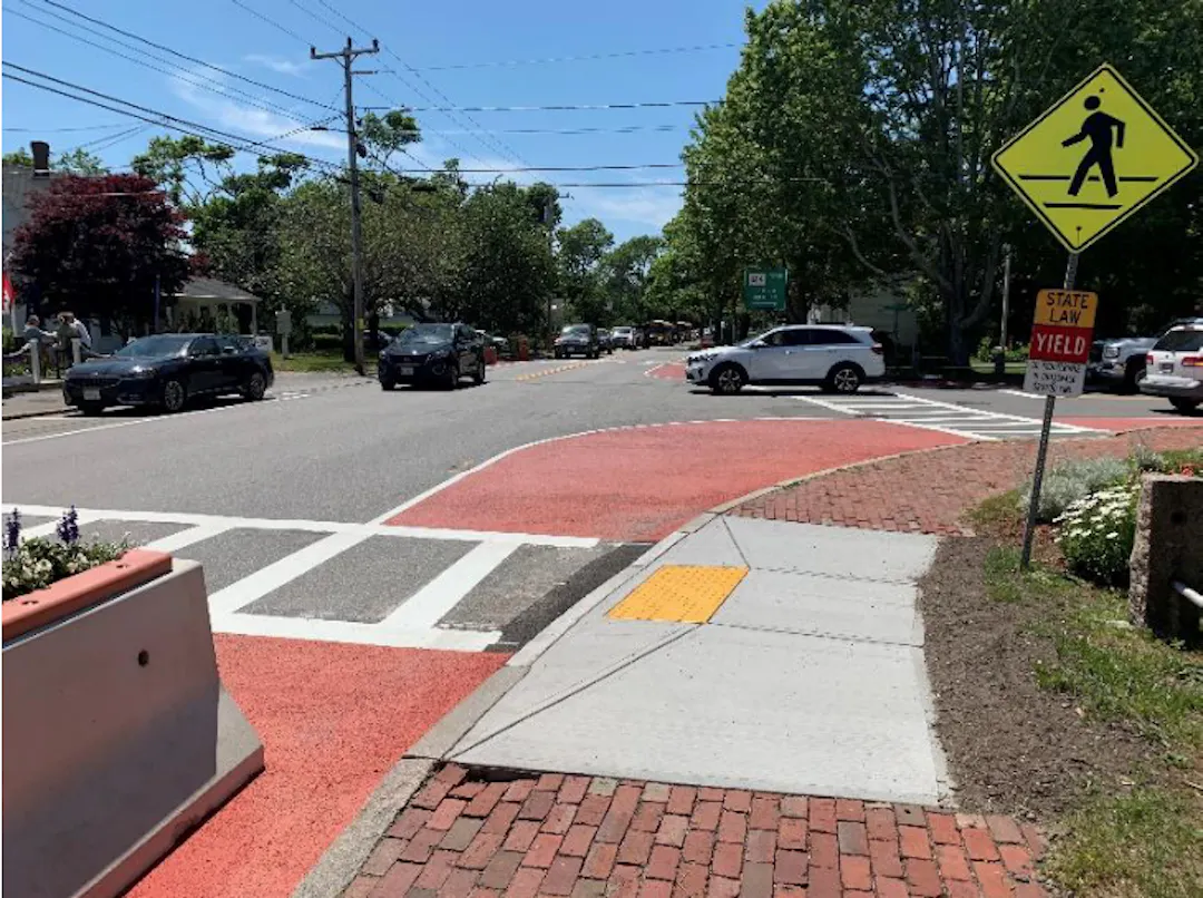
In 2021 we published the Lynn Safe Streets for People Playbook. This project was created with the goal of making Lynn's streets a safer, more comfortable experience for street users of all ages and abilities. It paired public input with research and data into a guide for future transportation safety improvements. Identified in the Playbook were Priority Projects, which are key roadway corridors and intersections for which safety improvements would have a high impact and could be implemented quickly using low-cost materials. The Quick Build project will address these Priority Projects.
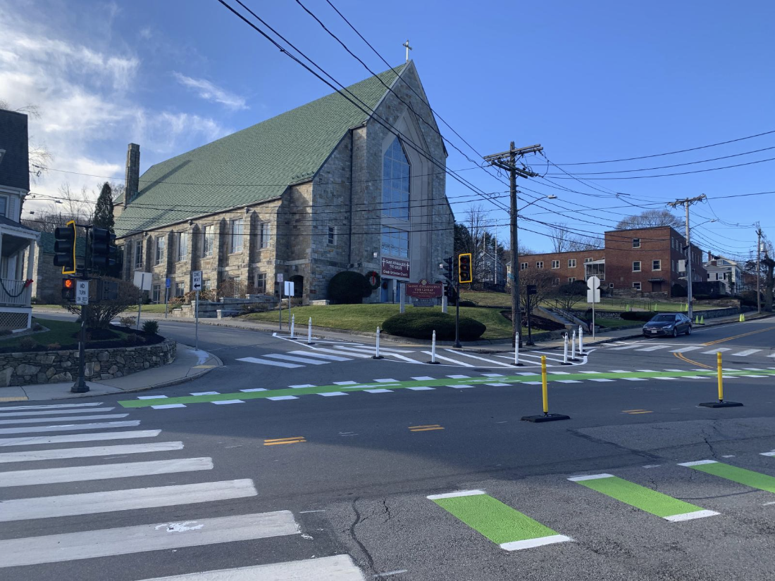
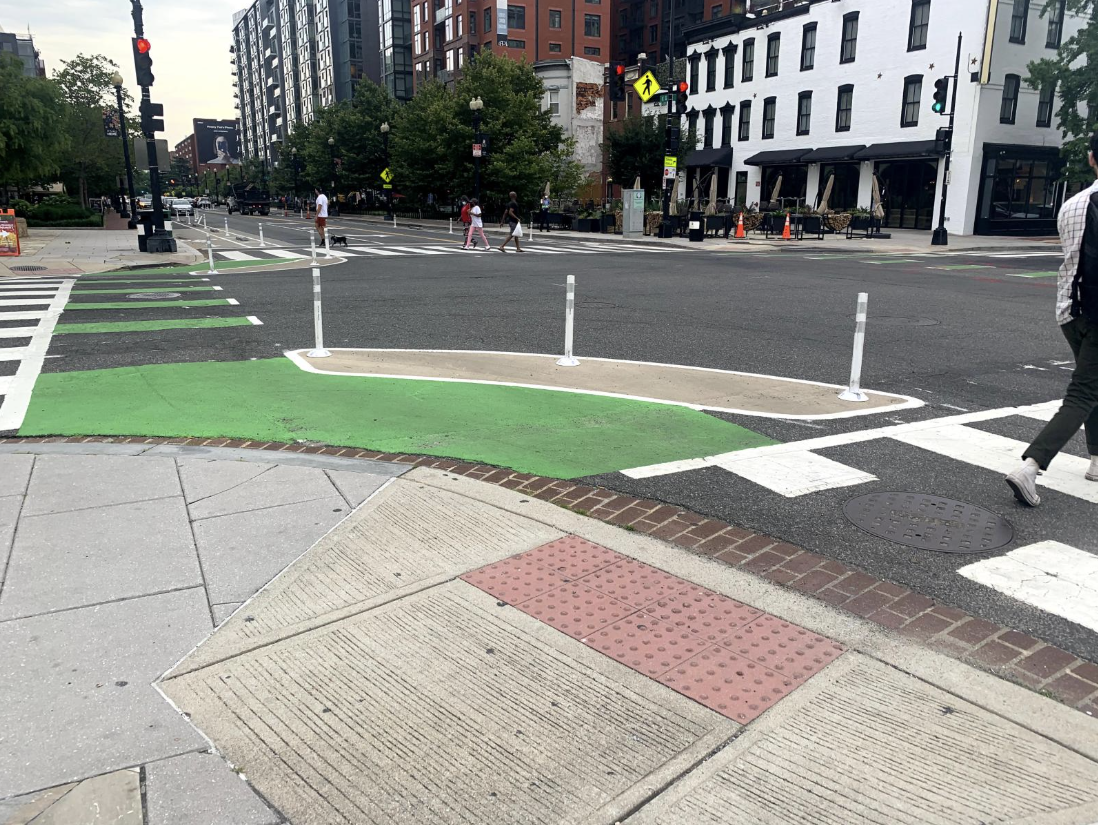
The Quick Build project carefully redesigns these key corridors and intersections to make them safer and more accessible for all street users using a simple palette of infrastructure interventions, including road markers, flex posts, and signage. These are a short-term interventions, planned to be installed in Spring 2027. Once in place, we will study each intervention and gather public feedback to assess their safety performances to inform the City's approach to long term safety solutions for these priority streets.
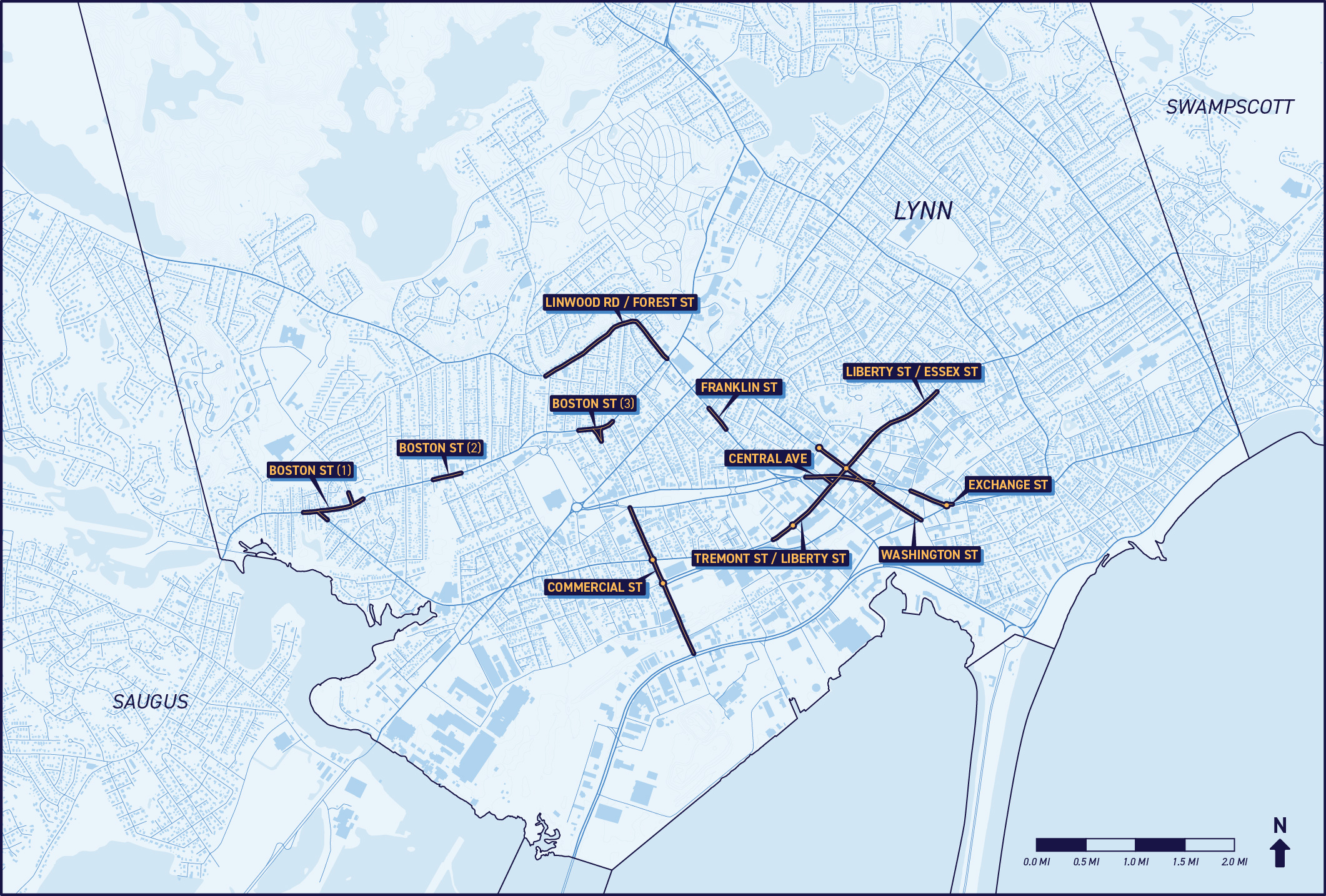
Project Locations:
- Boston Street
- Linwood Road and Forest Street
- Franklin Street
- Central Avenue and Exchange Street
- Tremont Street, Liberty Street, and Essex Street
- Washington Street
- Commercial Street
Street Design Treatments for Safety Improvements
In 2021 we published the Lynn Safe Streets for People Playbook. This project was created with the goal of making Lynn's streets a safer, more comfortable experience for street users of all ages and abilities. It paired public input with research and data into a guide for future transportation safety improvements. Identified in the Playbook were Priority Projects, which are key roadway corridors and intersections for which safety improvements would have a high impact and could be implemented quickly using low-cost materials. The Quick Build project will address these Priority Projects.
The Quick Build project carefully redesigns these key corridors and intersections to make them safer and more accessible for all street users using a simple palette of infrastructure interventions, including road markers, flex posts, and signage. These are a short-term interventions, planned to be installed in Spring 2027. Once in place, we will study each intervention and gather public feedback to assess their safety performances to inform the City's approach to long term safety solutions for these priority streets.
Project Locations:
- Boston Street
- Linwood Road and Forest Street
- Franklin Street
- Central Avenue and Exchange Street
- Tremont Street, Liberty Street, and Essex Street
- Washington Street
- Commercial Street
Street Design Treatments for Safety Improvements

-
Quick Build Toolkit + Strategies
Share Quick Build Toolkit + Strategies on Facebook Share Quick Build Toolkit + Strategies on X (formerly Twitter) Share Quick Build Toolkit + Strategies on Linkedin Email Quick Build Toolkit + Strategies linkThe Lynn Safe Streets for People Playbook helped identify a menu of street design treatments that can be installed across the City to improve street safety. These infrastructure interventions can improve street safety by addressing common root causes of crashes. This includes slowing down vehicle traffic, encouraging slower turns at intersections, shortening pedestrian crossing distances, and making people walking and biking more visible at intersections.
Daylighting
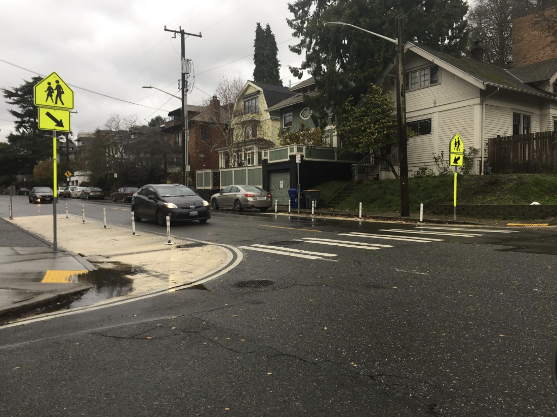
Daylighting refers to the removal of street parking spaces around intersections and crossings. This allows drivers to see pedestrians entering crosswalks sooner, making them more likely to yield to pedestrians. On streets with bikeContinue readingThe Lynn Safe Streets for People Playbook helped identify a menu of street design treatments that can be installed across the City to improve street safety. These infrastructure interventions can improve street safety by addressing common root causes of crashes. This includes slowing down vehicle traffic, encouraging slower turns at intersections, shortening pedestrian crossing distances, and making people walking and biking more visible at intersections.
Daylighting
Daylighting refers to the removal of street parking spaces around intersections and crossings. This allows drivers to see pedestrians entering crosswalks sooner, making them more likely to yield to pedestrians. On streets with bike lanes, daylighting can also make people biking more visible to vehicle traffic as they approach intersections. Curb Extensions
Curb extensions, or “bump outs,” are extensions of the sidewalk into the parking lane at intersections. They shorten the crossing distance for people walking, encourage drivers to make tighter and slower turns, and can provide space for public amenities like bike parking, benches, and greenery. Curb extensions also serve to daylight intersections. Geometric Intersection Changes

Particularly in places like Lynn with irregular street grids, streets that meet at unusual angles may create intersections that are confusing, have difficult sight-lines, or encourage high speeds and fast turns. Geometric changes that reshape curbs and edges to reduce excess space for vehicles at intersections and make them function more conventionally can address some of these issues. Geometric changes may also provide opportunities for the placement of public amenities like benches, bike parking, and trees.
Protected Intersections

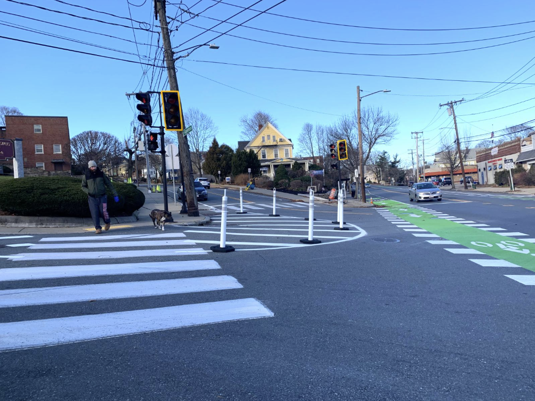
Protected intersections guide people biking safely and comfortable through intersections by providing them queuing space, making them visible to drivers, and slowing turning drivers. These changes also shorten crossing distances and make intersections safer for people walking.
Raised Crosswalks

Raised crosswalks elevate crossings to the sidewalk level, providing a continuous path of travel for people walking and making vehicle traffic ramp up and back down at crosswalks. This reinforces the priority of pedestrians in crosswalks, makes people crossing more visible, and slows vehicle traffic at crosswalks.
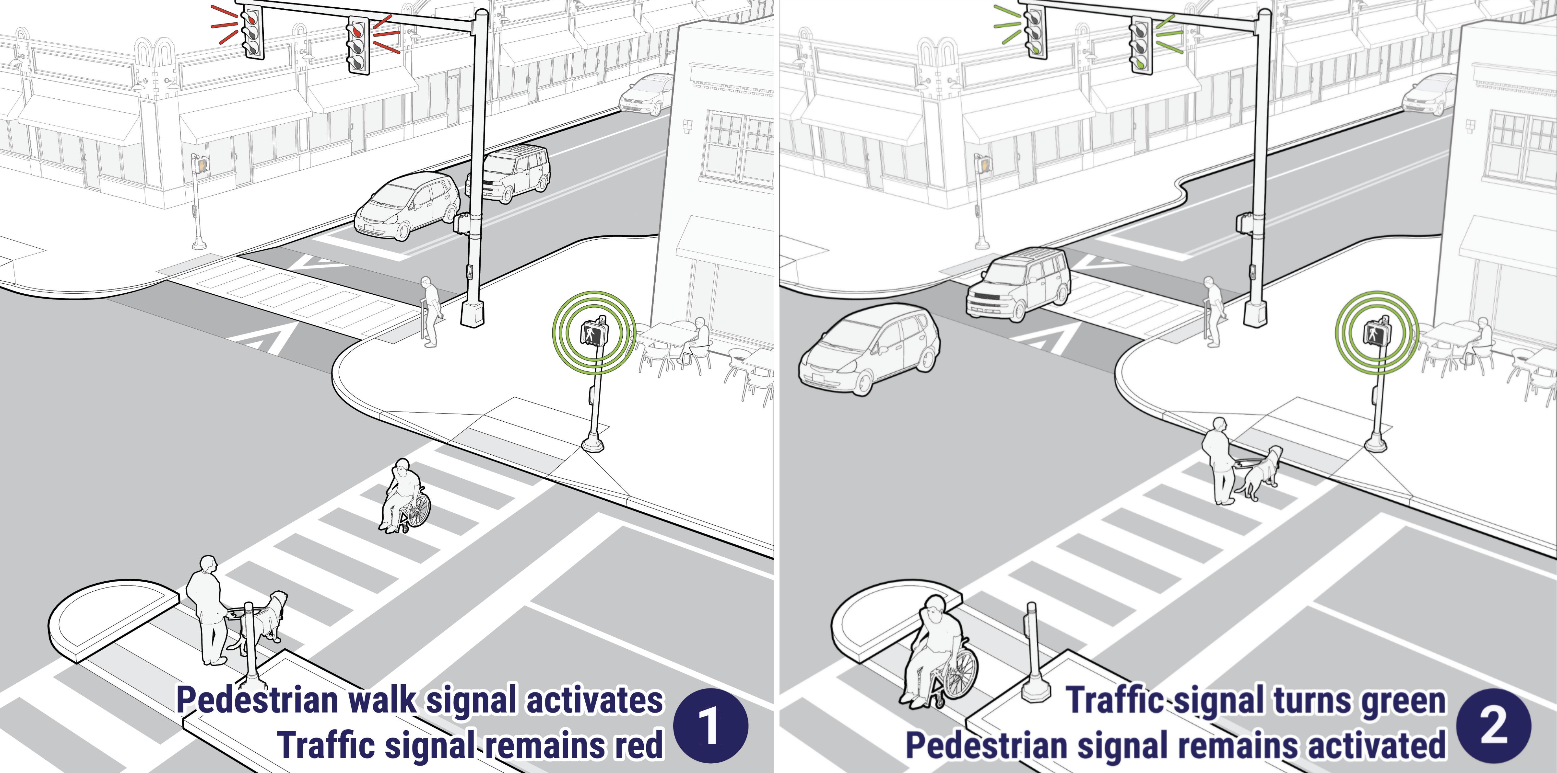
Leading Pedestrian Interval (LPI) Signal Phasing

LPI phasing at intersections with signals gives people walking a 3-7 second head start to begin crossing before the corresponding vehicle signal turns green. This head start serves to reinforce pedestrian priority over turning vehicle traffic and make people crossing more visible to drivers.
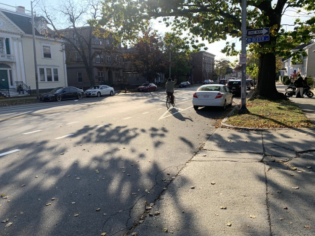
Bike Lanes
Bike lanes improve safety for all road users by giving people biking a dedicated space on the road, reducing conflicts with people walking on the sidewalk or driving. Bike lanes can also provide people with an additional option for reaching their destination.
-
Boston St
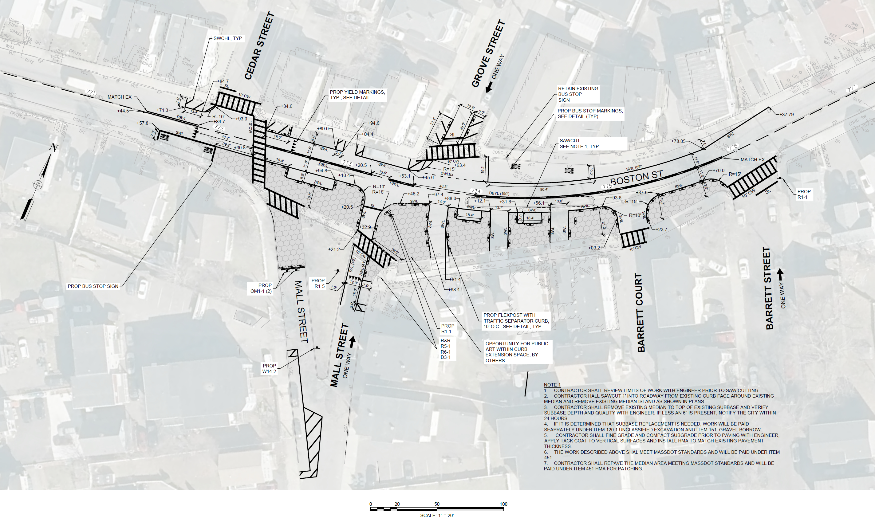
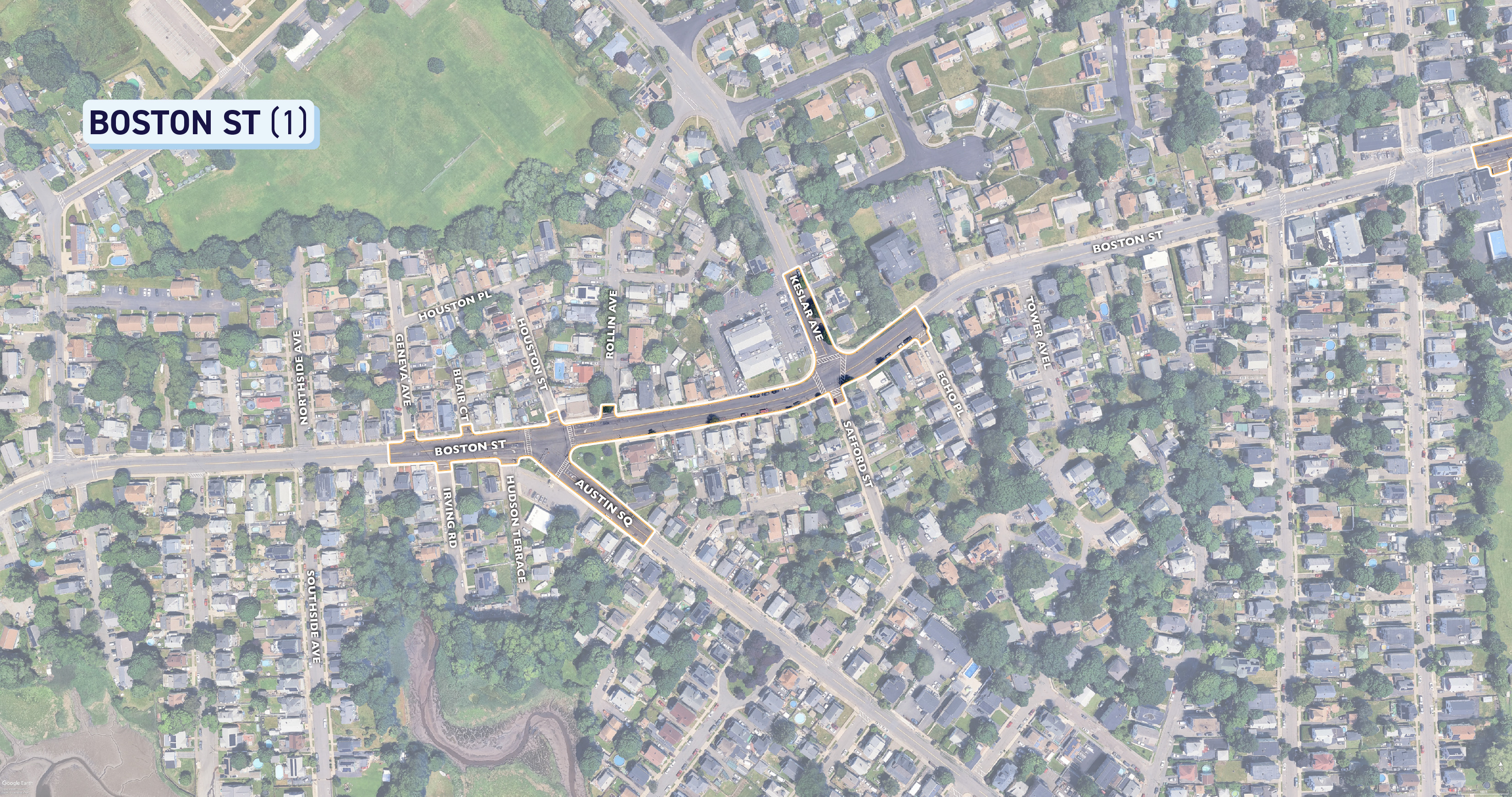
Share Boston St on Facebook Share Boston St on X (formerly Twitter) Share Boston St on Linkedin Email Boston St linkSee below for diagrams depicting the extents of the project as well as specific details on the design. To get a closer look, right click on the images to download or open in a new tab!
BOSTON ST (1)
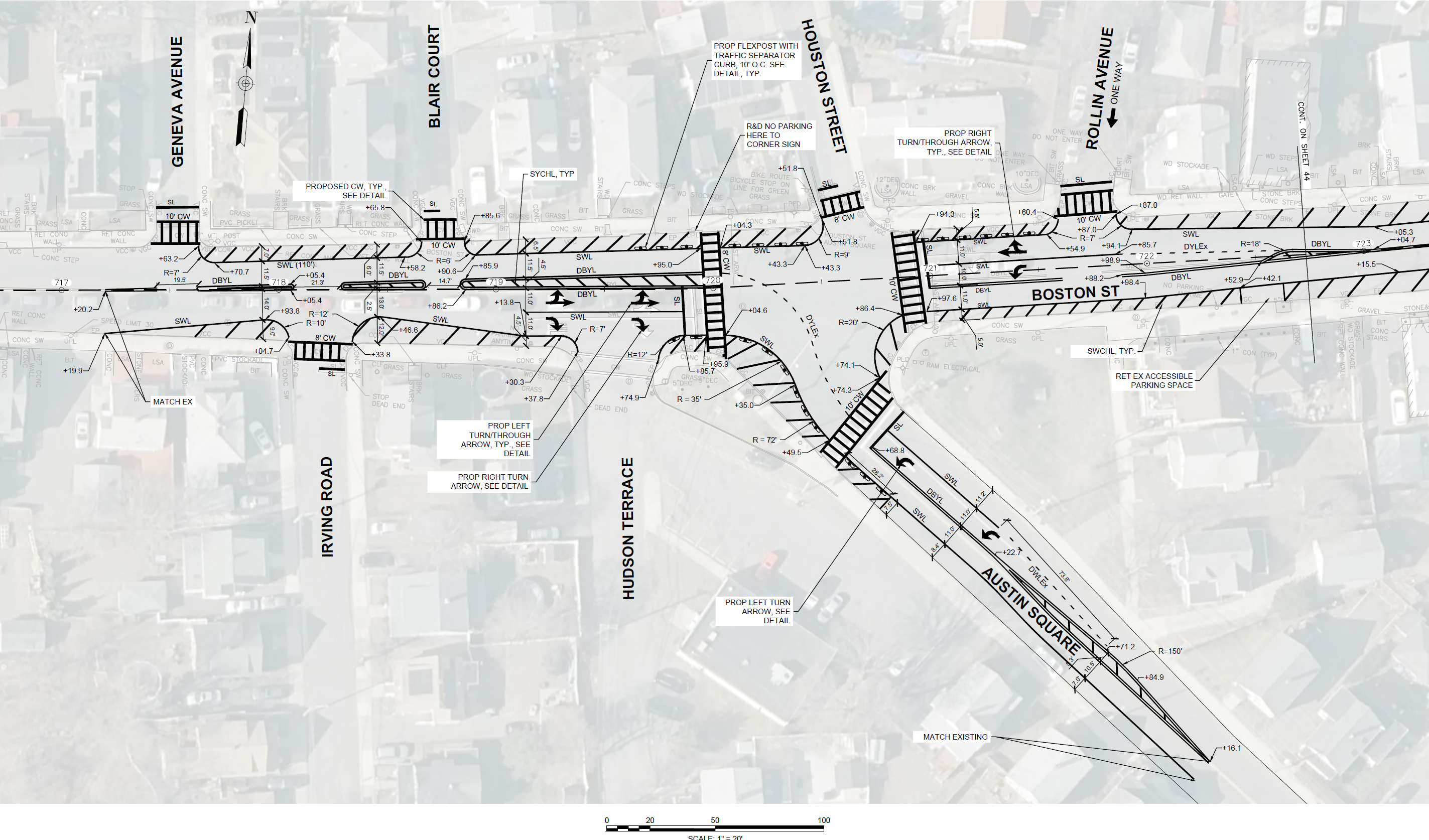
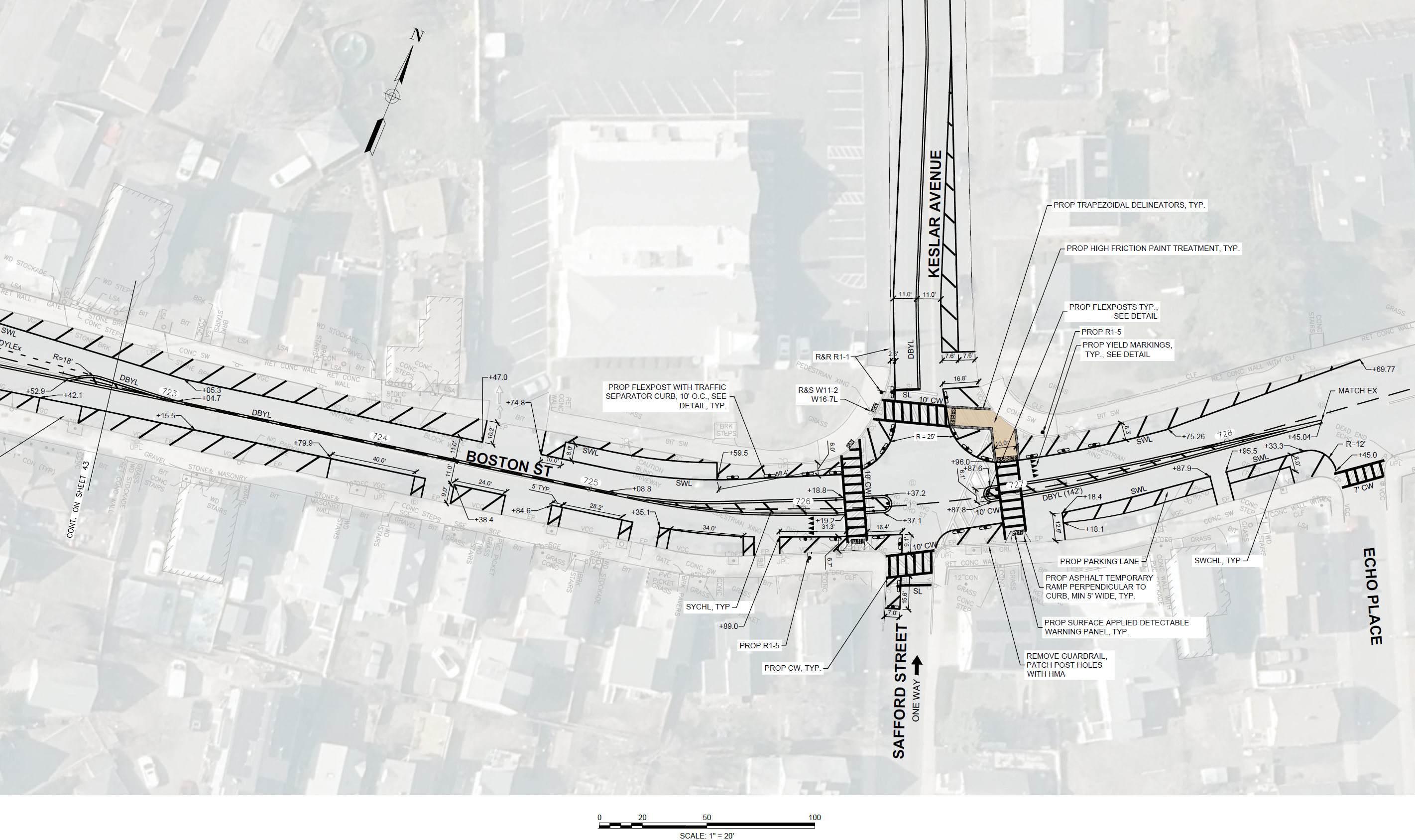
This Western portion of Boston St stretches from Geneva Ave to Echo Pl, and includes a small part of Austin Square.
BOSTON ST (2)
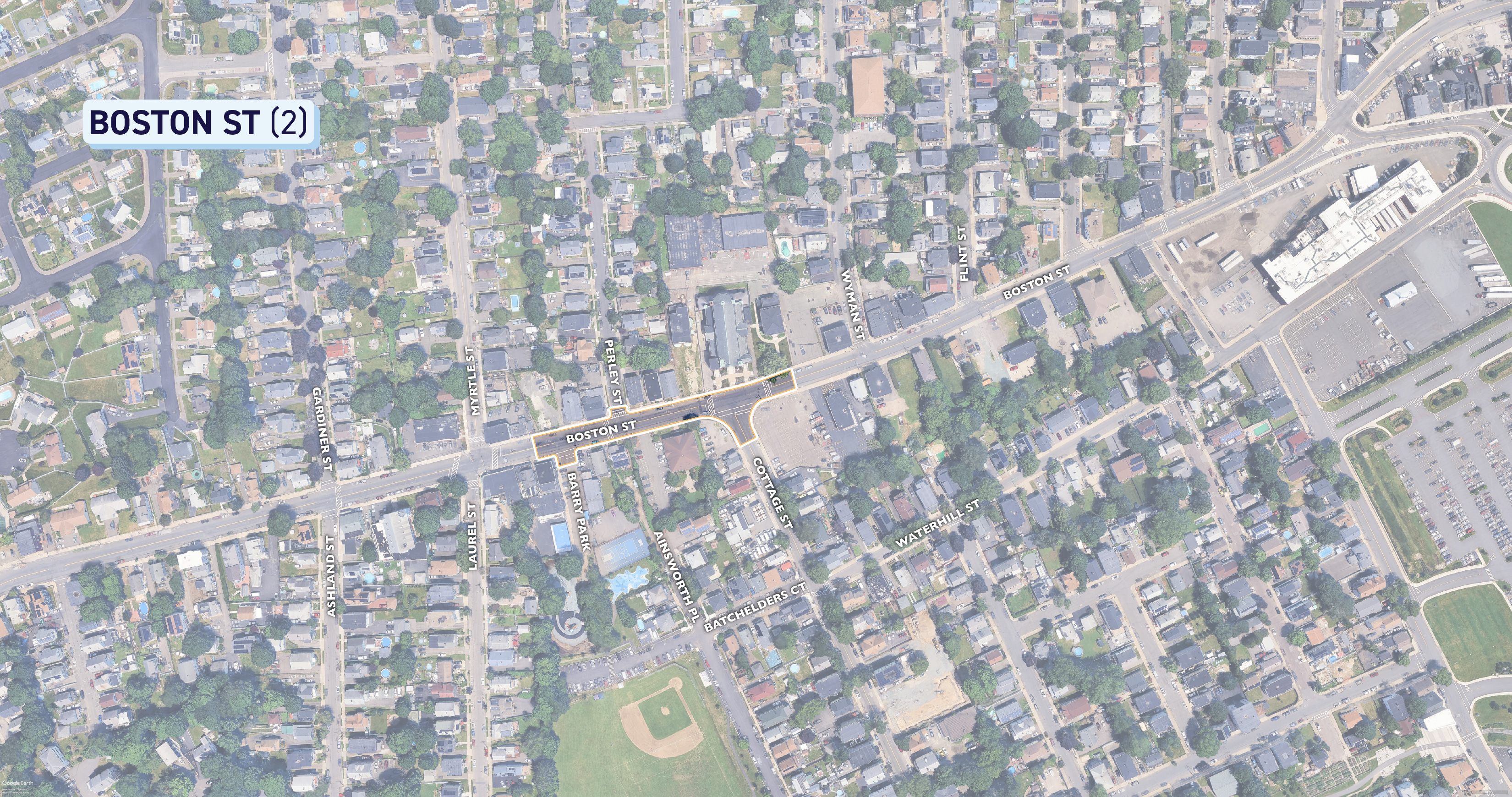
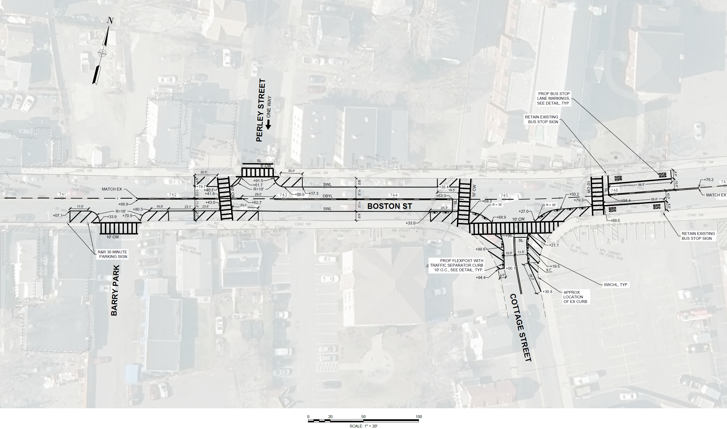
This small portion of Boston St stretches from Barry Park until just past Cottage Street.
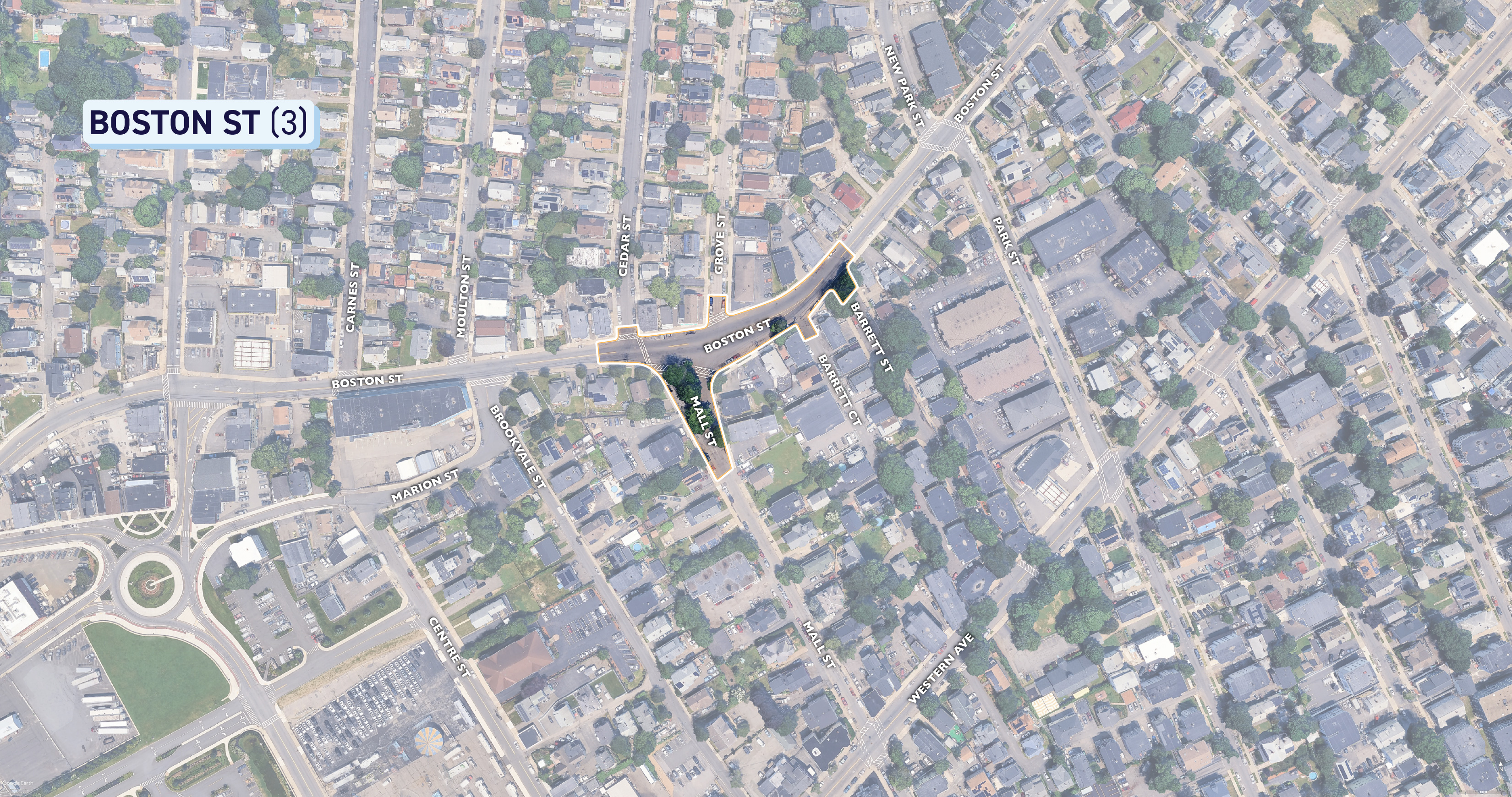
BOSTON ST (3)
This small portion of Boston St stretches from Cedar Street to Barrett Street, and includes a portion of MallContinue reading
See below for diagrams depicting the extents of the project as well as specific details on the design. To get a closer look, right click on the images to download or open in a new tab!
BOSTON ST (1)
This Western portion of Boston St stretches from Geneva Ave to Echo Pl, and includes a small part of Austin Square.


BOSTON ST (2)
This small portion of Boston St stretches from Barry Park until just past Cottage Street.


BOSTON ST (3)
This small portion of Boston St stretches from Cedar Street to Barrett Street, and includes a portion of Mall Street where it intersects with Boston Street.


-
Linwood Rd / Forest St
Share Linwood Rd / Forest St on Facebook Share Linwood Rd / Forest St on X (formerly Twitter) Share Linwood Rd / Forest St on Linkedin Email Linwood Rd / Forest St linkLINWOOD RD / N FRANKLIN ST
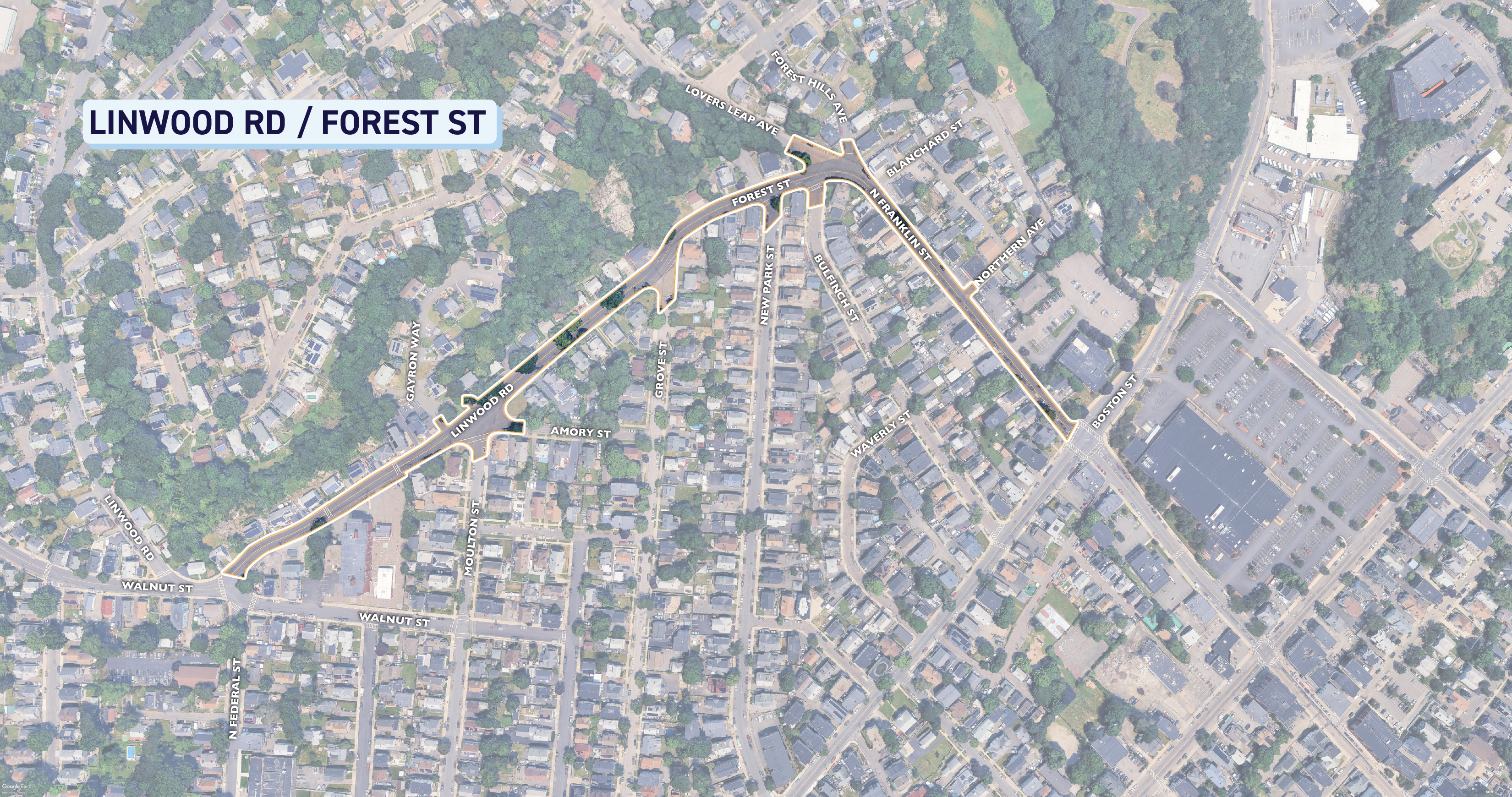
This stretches from where Linwood Rd intersects with Walnut St, includes small portions of intersections with Moulton St, Amory St, and Grove St. This section then continues onto Forest St through to N Franklin St, terminating before the intersection with Boston St. See below for diagrams depicting the extents of the project as well as specific details on the design. To get a closer look, right click on the images to download or open in a new tab!

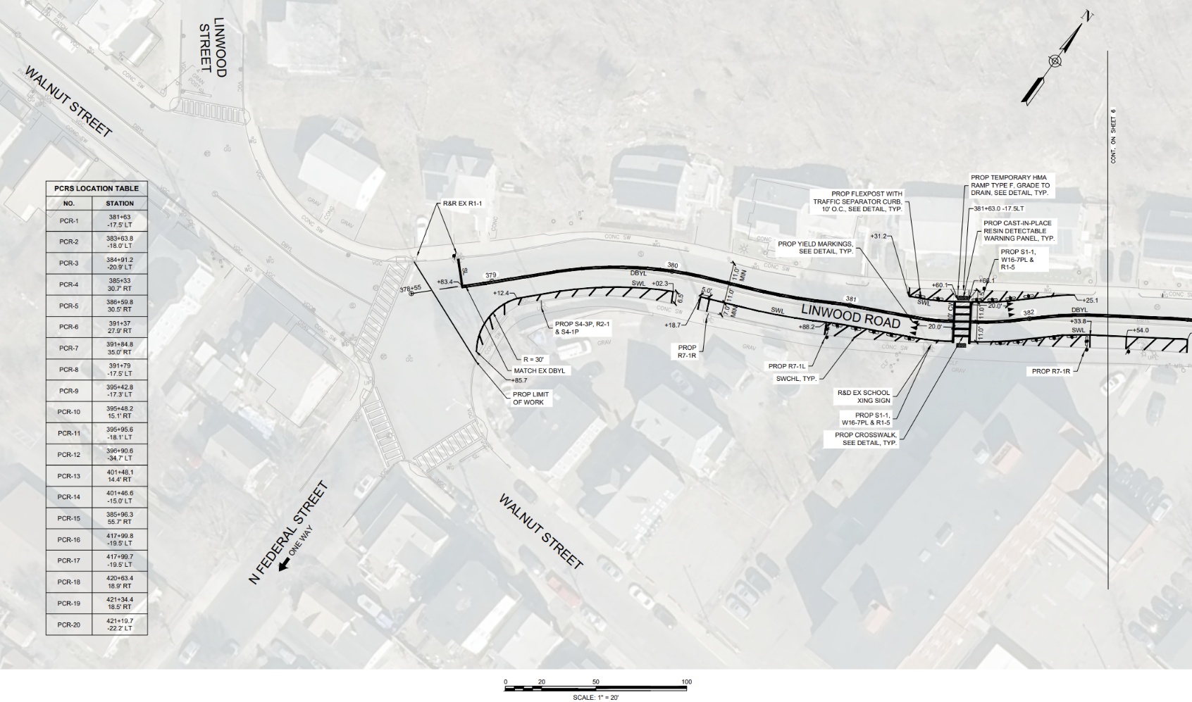
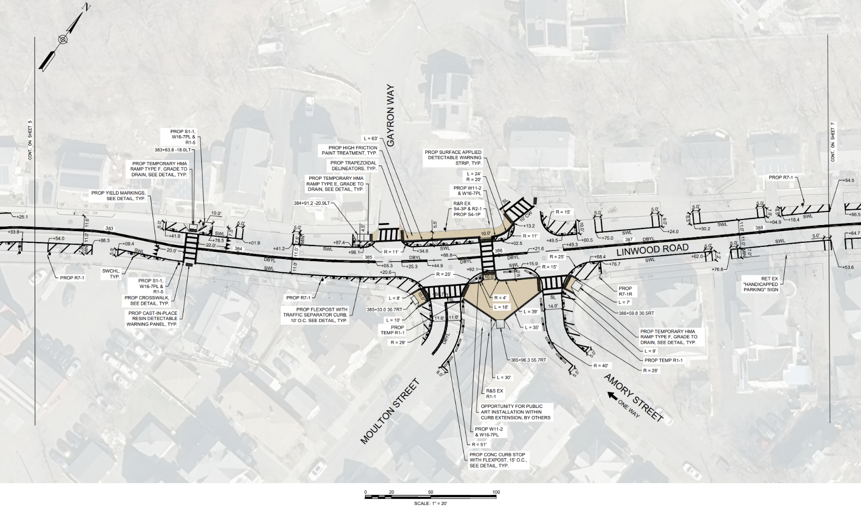
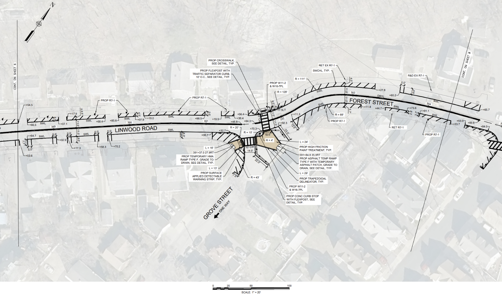
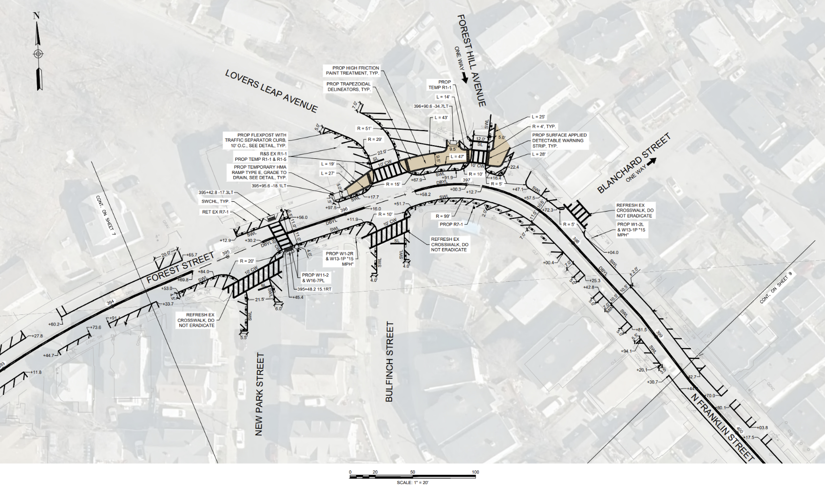
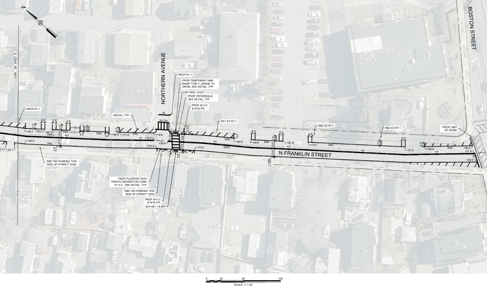
LINWOOD RD / N FRANKLIN ST
This stretches from where Linwood Rd intersects with Walnut St, includes small portions of intersections with Moulton St, Amory St, and Grove St. This section then continues onto Forest St through to N Franklin St, terminating before the intersection with Boston St. See below for diagrams depicting the extents of the project as well as specific details on the design. To get a closer look, right click on the images to download or open in a new tab!


-
Franklin St
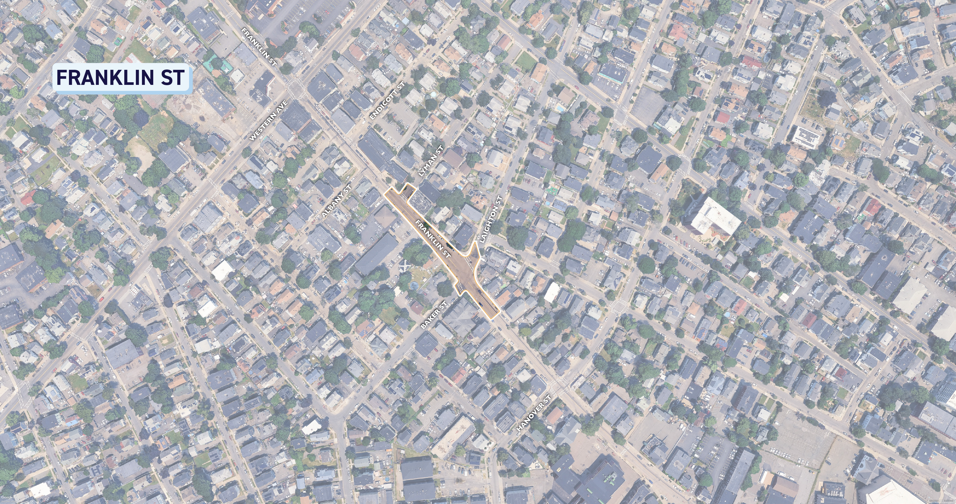
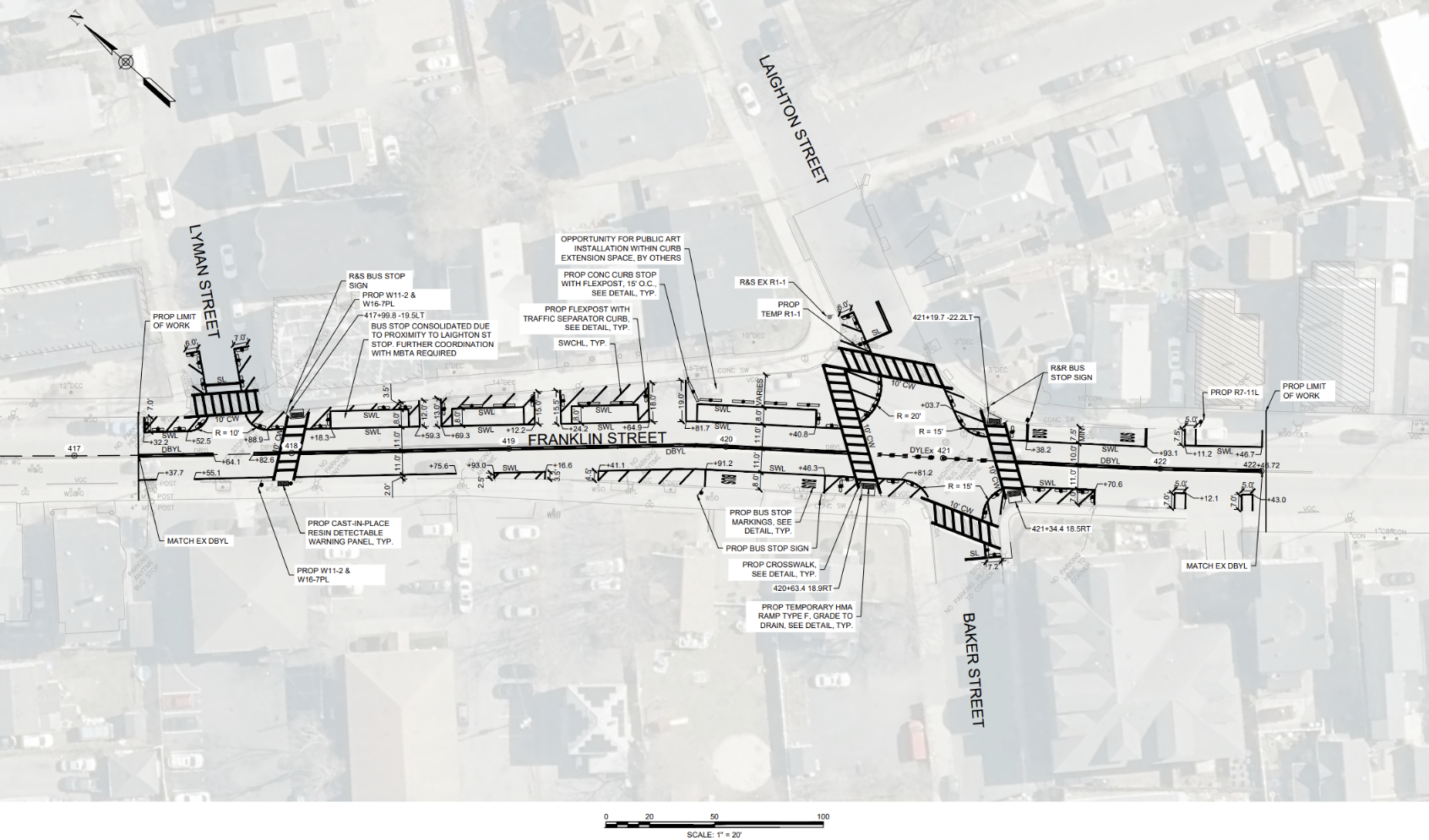
Share Franklin St on Facebook Share Franklin St on X (formerly Twitter) Share Franklin St on Linkedin Email Franklin St linkFRANKLIN ST
This portion begins from where Franklin St meets Lyman St, and heads Southeast stretching a short distance past Baker St. See below for diagrams depicting the extents of the project as well as specific details on the design. To get a closer look, right click on the images to download or open in a new tab!
FRANKLIN ST
This portion begins from where Franklin St meets Lyman St, and heads Southeast stretching a short distance past Baker St. See below for diagrams depicting the extents of the project as well as specific details on the design. To get a closer look, right click on the images to download or open in a new tab!


-
Central Ave / Exchange St
Share Central Ave / Exchange St on Facebook Share Central Ave / Exchange St on X (formerly Twitter) Share Central Ave / Exchange St on Linkedin Email Central Ave / Exchange St linkCENTRAL AVE
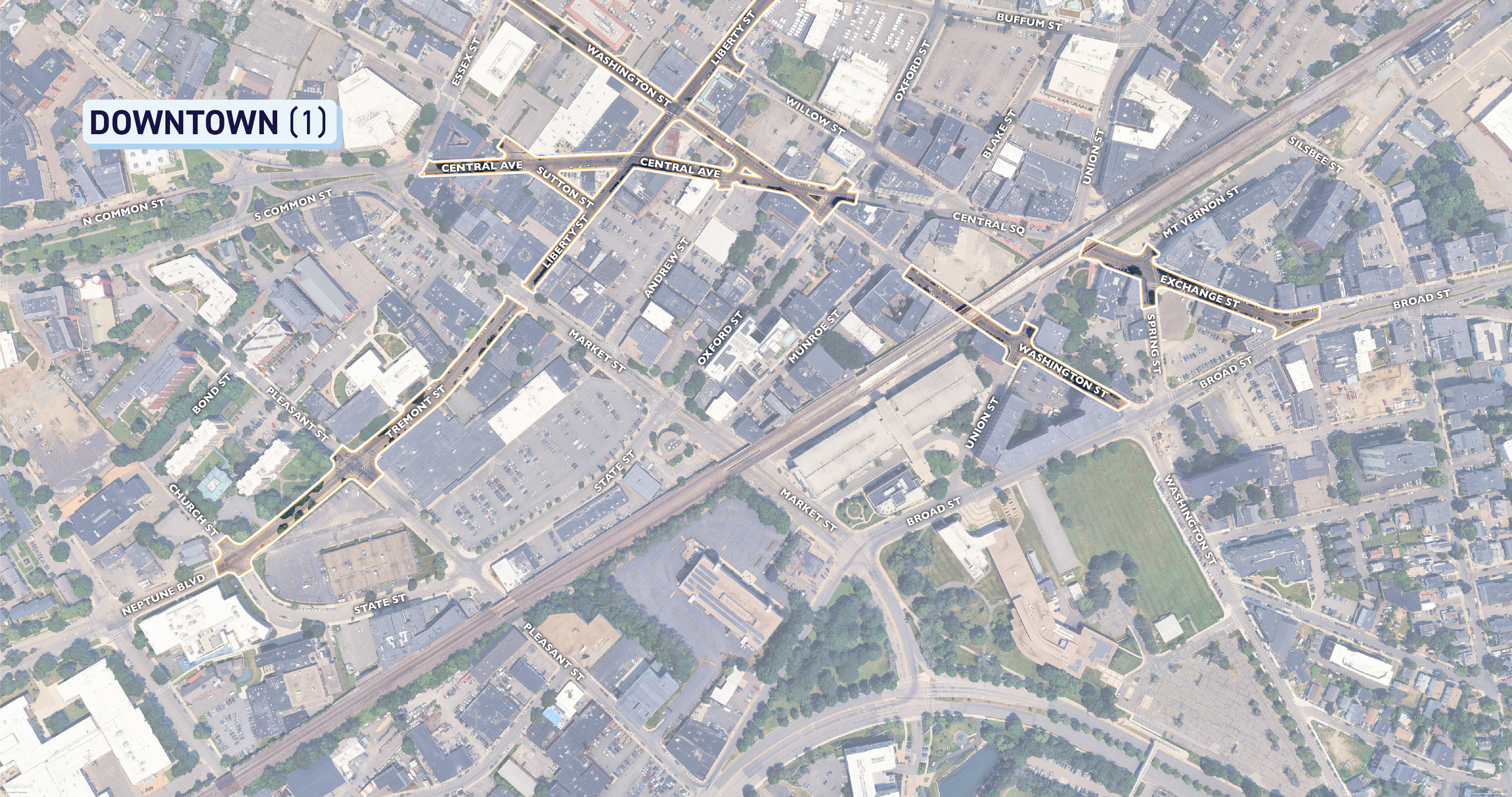
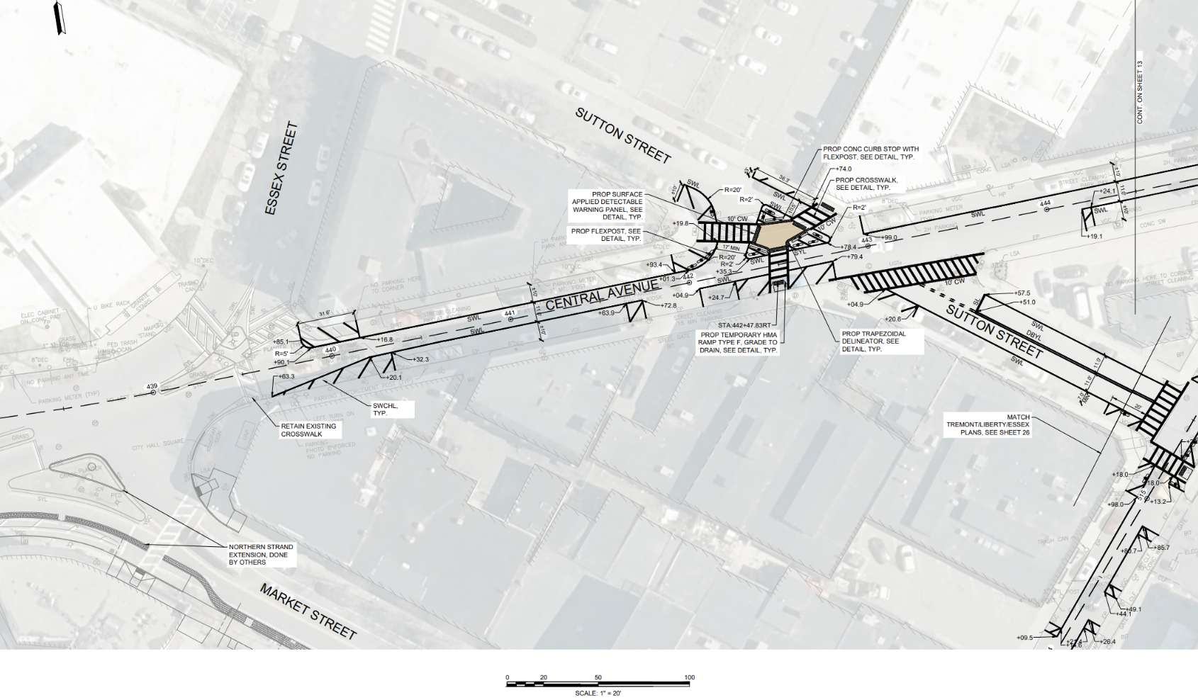
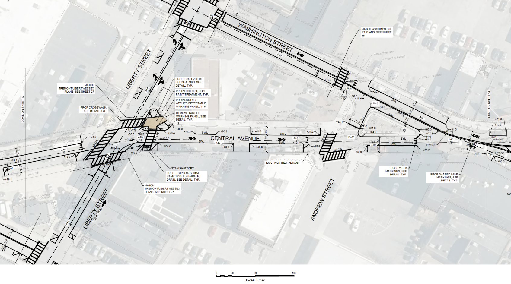
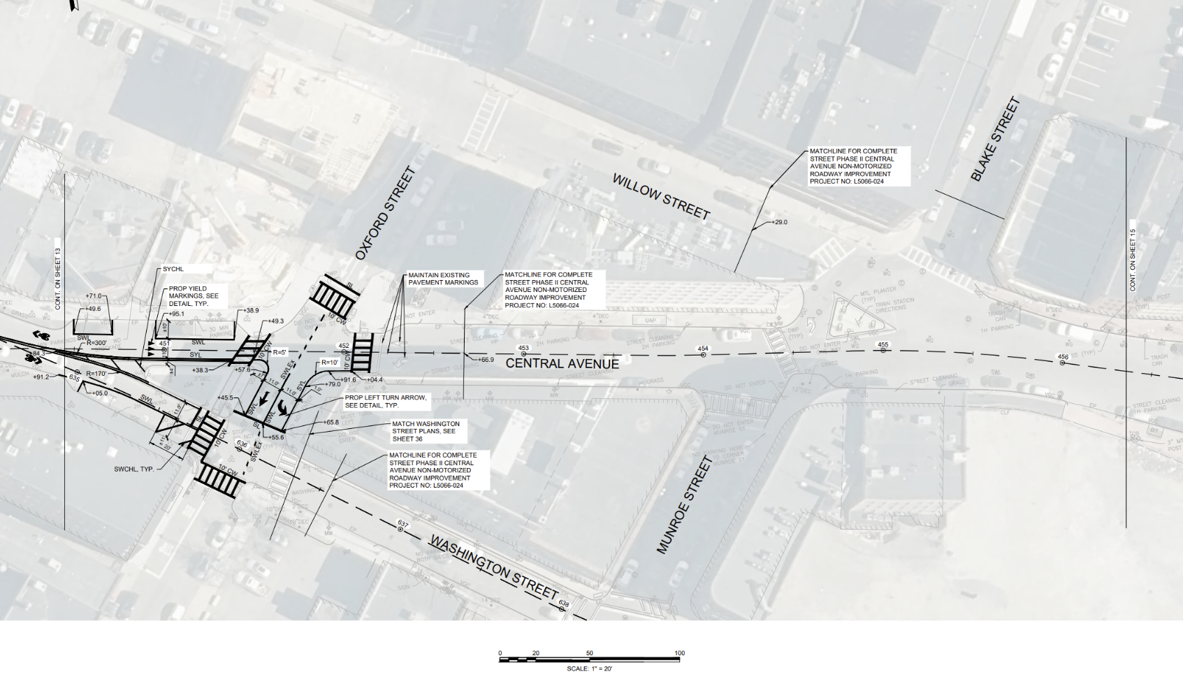
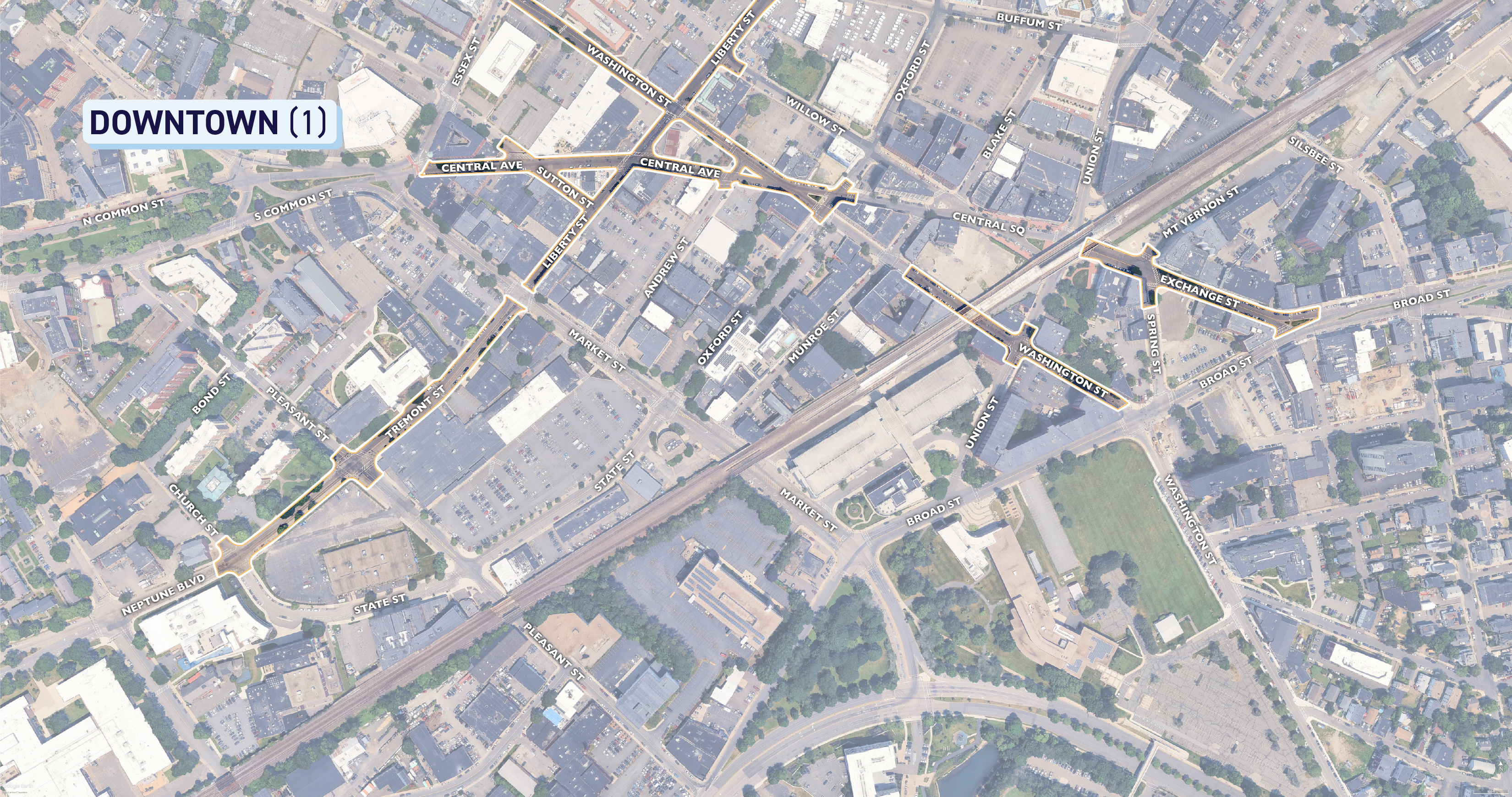
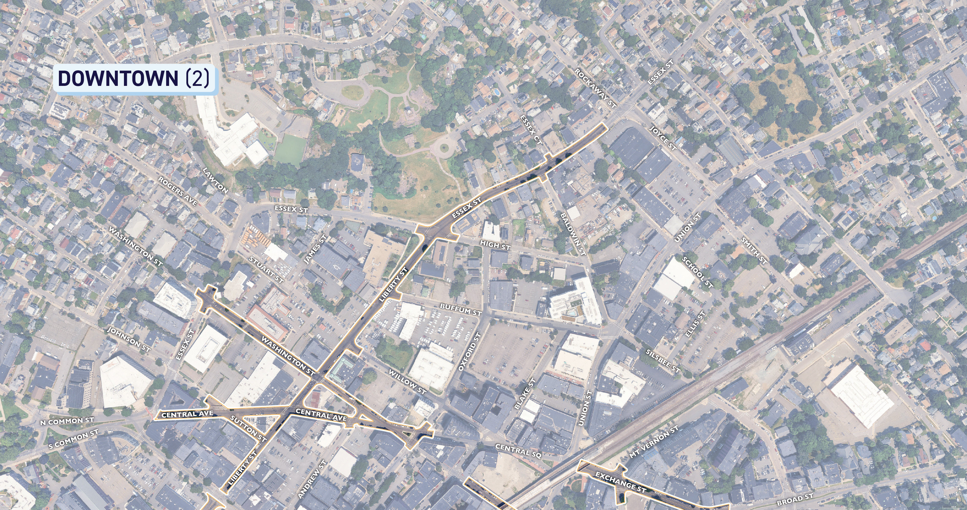
This portion begins from where Central Ave meets South and North Common St, then heads East past Liberty St, then Southeast until intersecting with Oxford St. See below for diagrams depicting the extents of the project as well as specific details on the design. To get a closer look, right click on the images to download or open in a new tab!


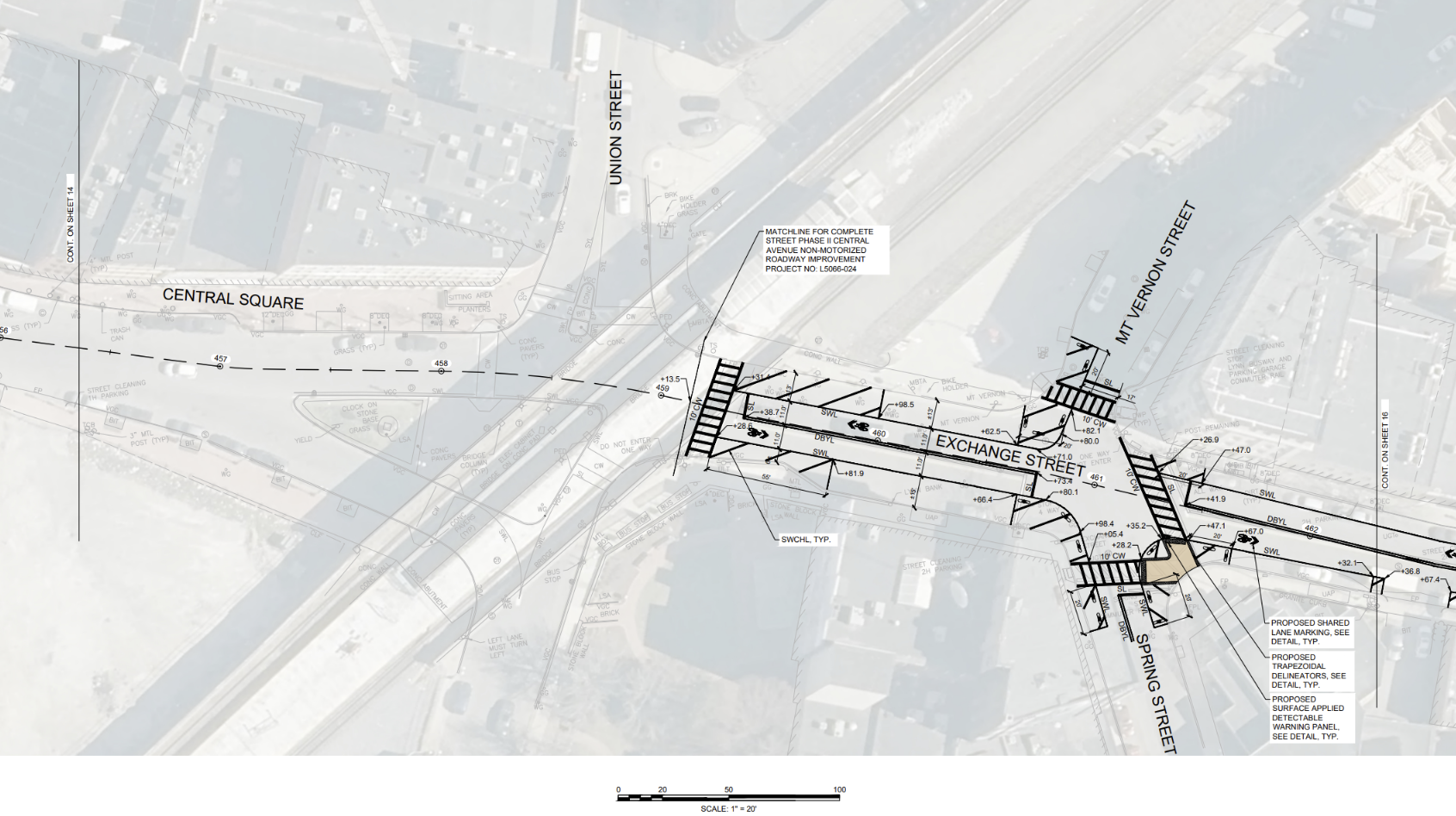
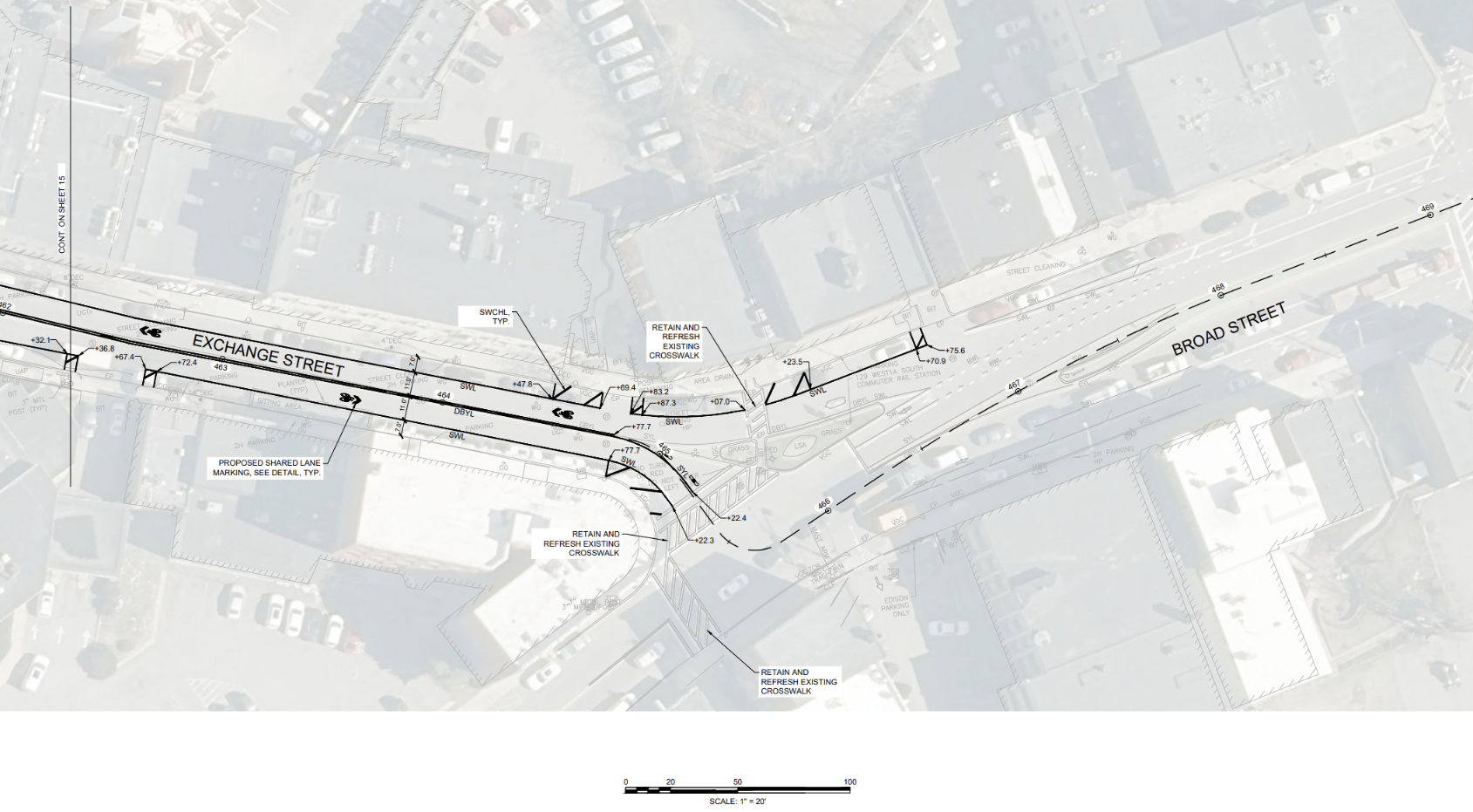
EXCHANGE ST
This portion begins at Exchange St underneath the train bridge in Central Square, then heads Southeast until Exchange St intersects with Broad St.
CENTRAL AVE
This portion begins from where Central Ave meets South and North Common St, then heads East past Liberty St, then Southeast until intersecting with Oxford St. See below for diagrams depicting the extents of the project as well as specific details on the design. To get a closer look, right click on the images to download or open in a new tab!
EXCHANGE ST
This portion begins at Exchange St underneath the train bridge in Central Square, then heads Southeast until Exchange St intersects with Broad St.


-
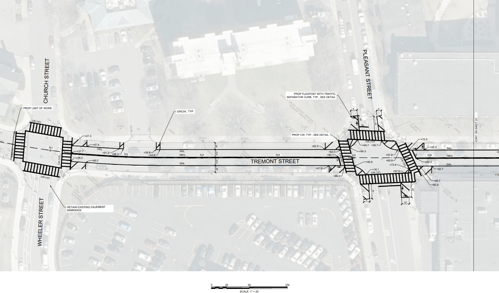
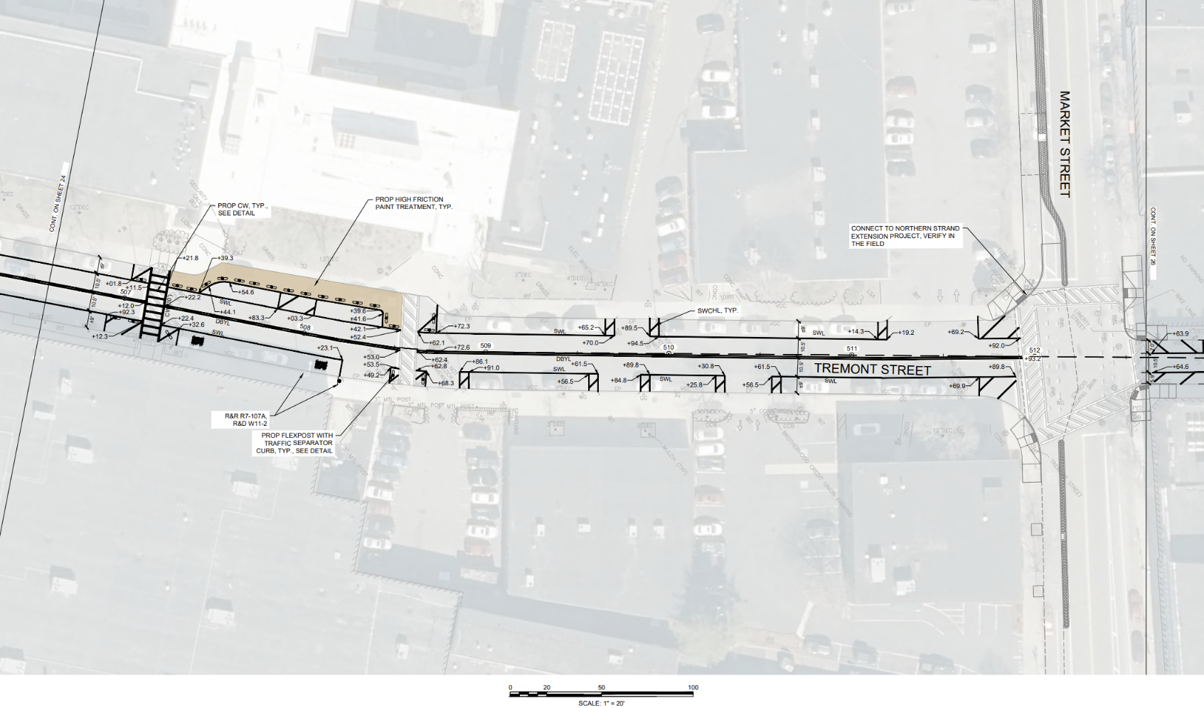
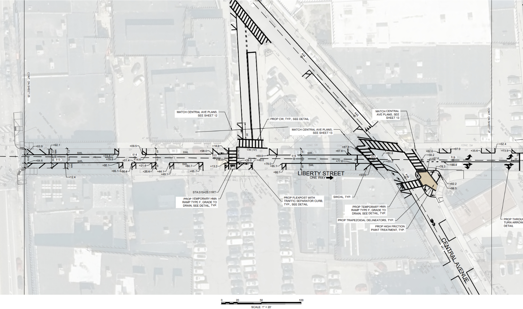
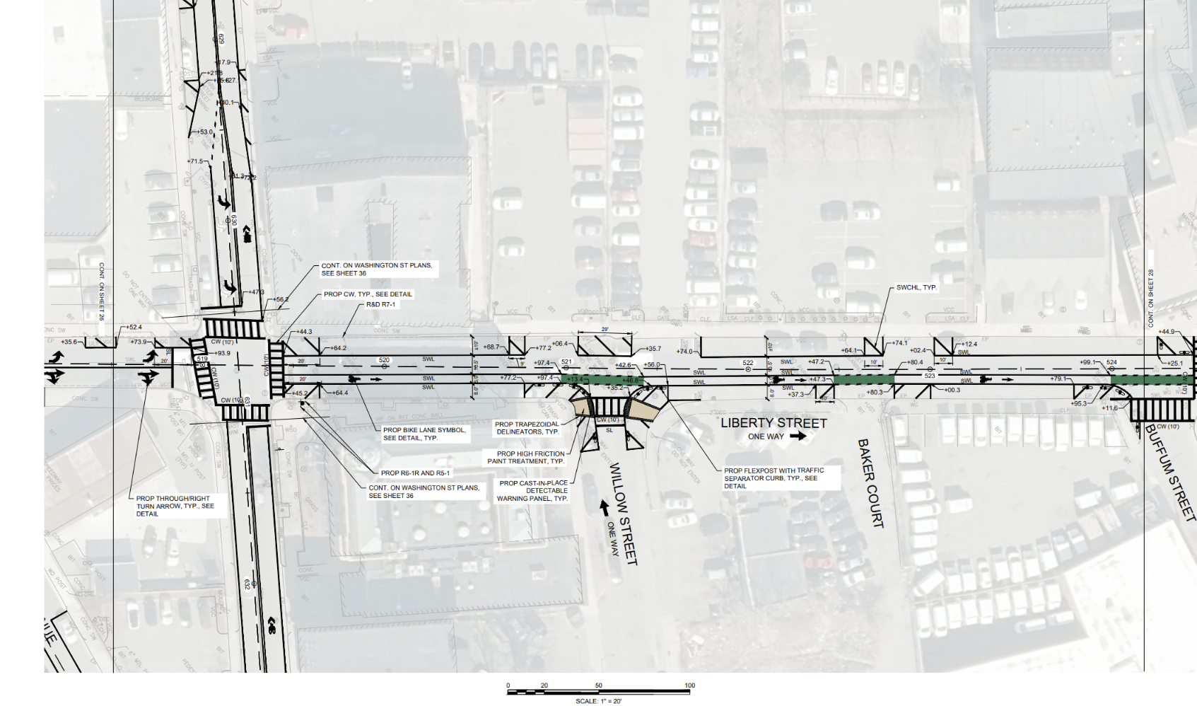
Tremont St / Liberty St / Essex St
Share Tremont St / Liberty St / Essex St on Facebook Share Tremont St / Liberty St / Essex St on X (formerly Twitter) Share Tremont St / Liberty St / Essex St on Linkedin Email Tremont St / Liberty St / Essex St linkTREMONT ST / LIBERTY ST / ESSEX ST
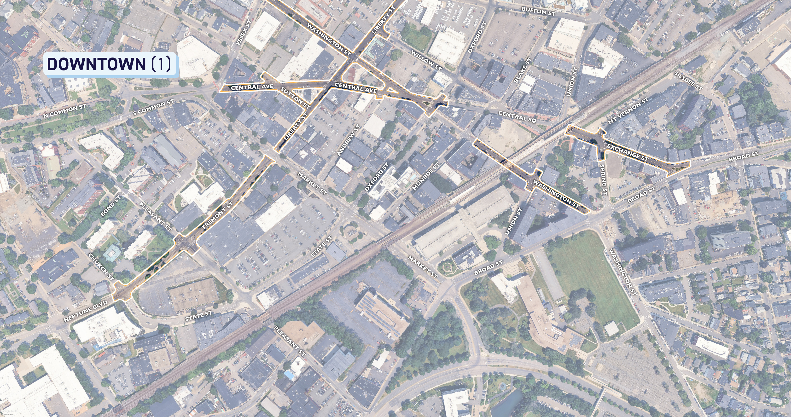
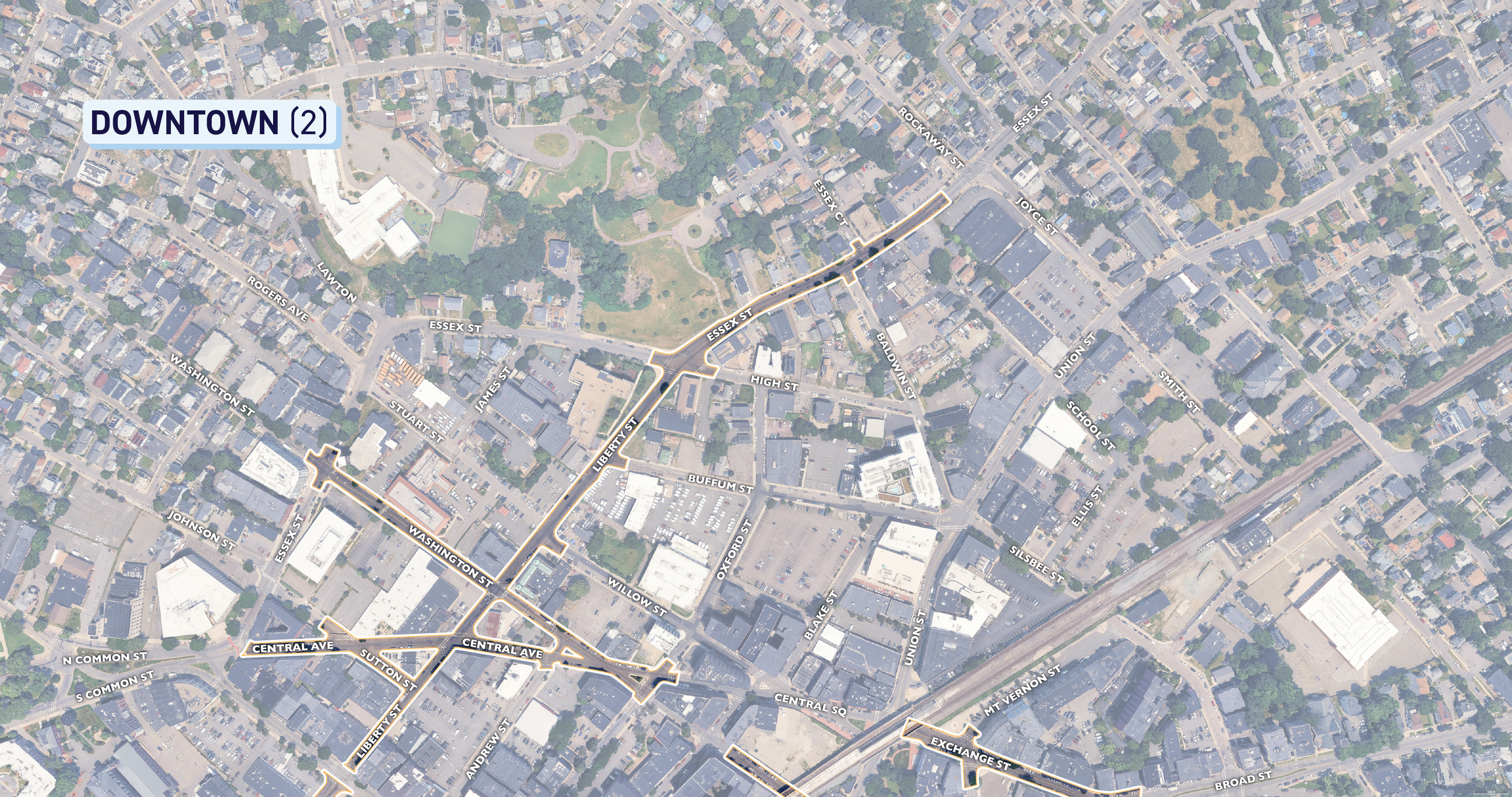
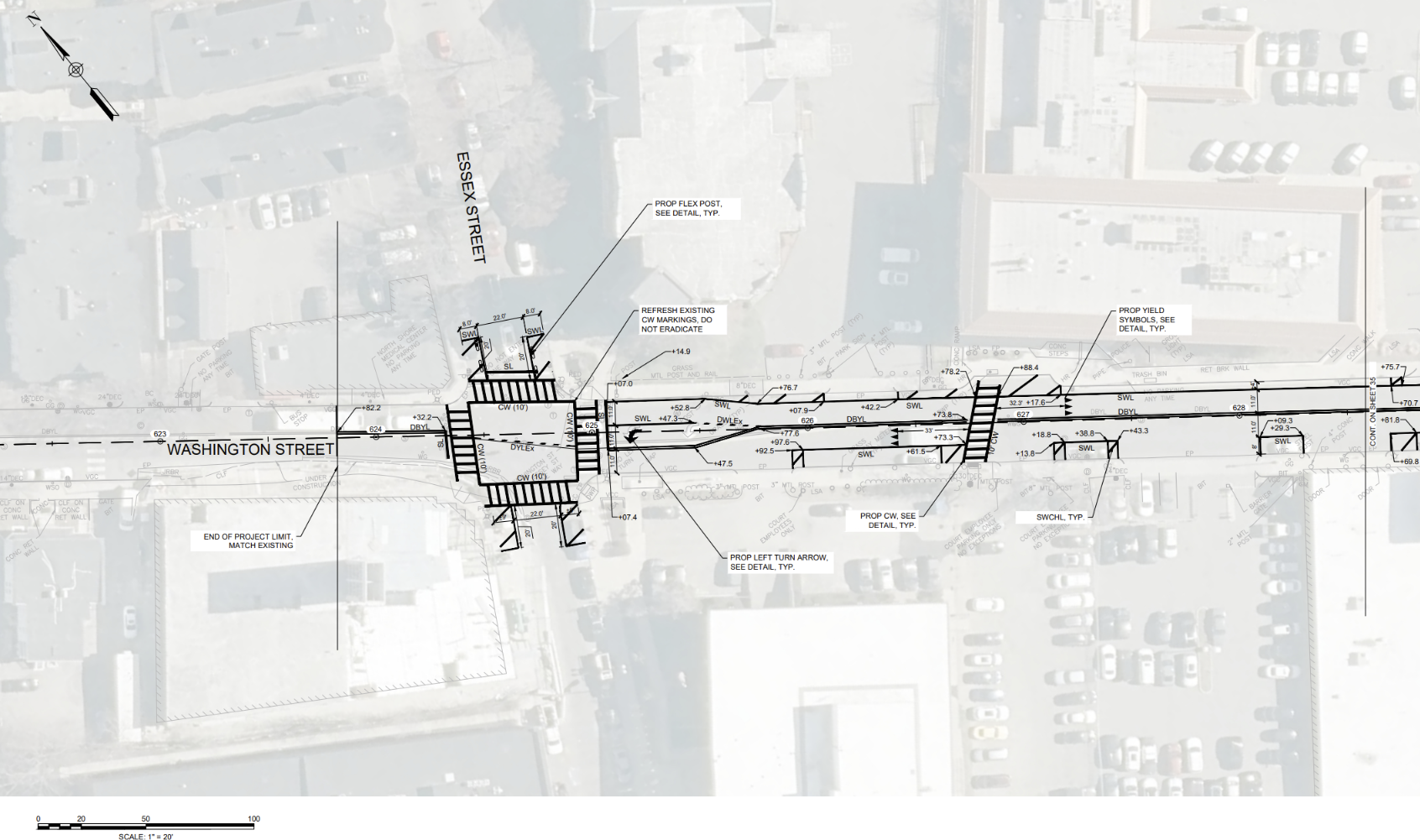
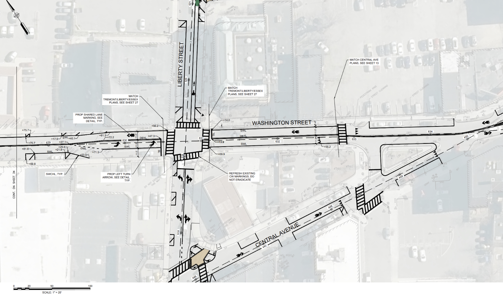
This long corridor begins where Tremont St intersects with Church St and Wheeler St, then heads Northeast before skipping over Market St and picking back up at Liberty St. It then continues Northeast through to Essex St before terminating shortly before Essex St meets Rockaway St. See below for diagrams depicting the extents of the project as well as specific details on the design. To get a closer look, right click on the images to download or open in a new tab!


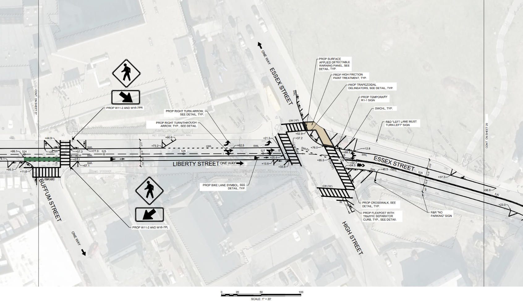
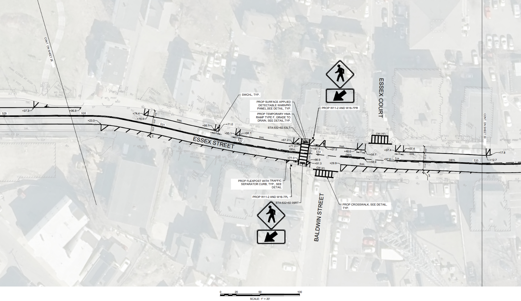
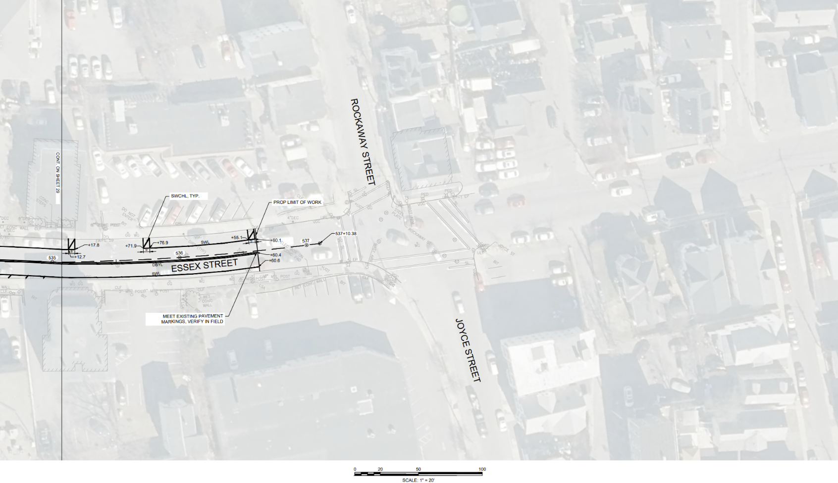
TREMONT ST / LIBERTY ST / ESSEX ST
This long corridor begins where Tremont St intersects with Church St and Wheeler St, then heads Northeast before skipping over Market St and picking back up at Liberty St. It then continues Northeast through to Essex St before terminating shortly before Essex St meets Rockaway St. See below for diagrams depicting the extents of the project as well as specific details on the design. To get a closer look, right click on the images to download or open in a new tab!


-
Washington St
Share Washington St on Facebook Share Washington St on X (formerly Twitter) Share Washington St on Linkedin Email Washington St linkWASHINGTON ST
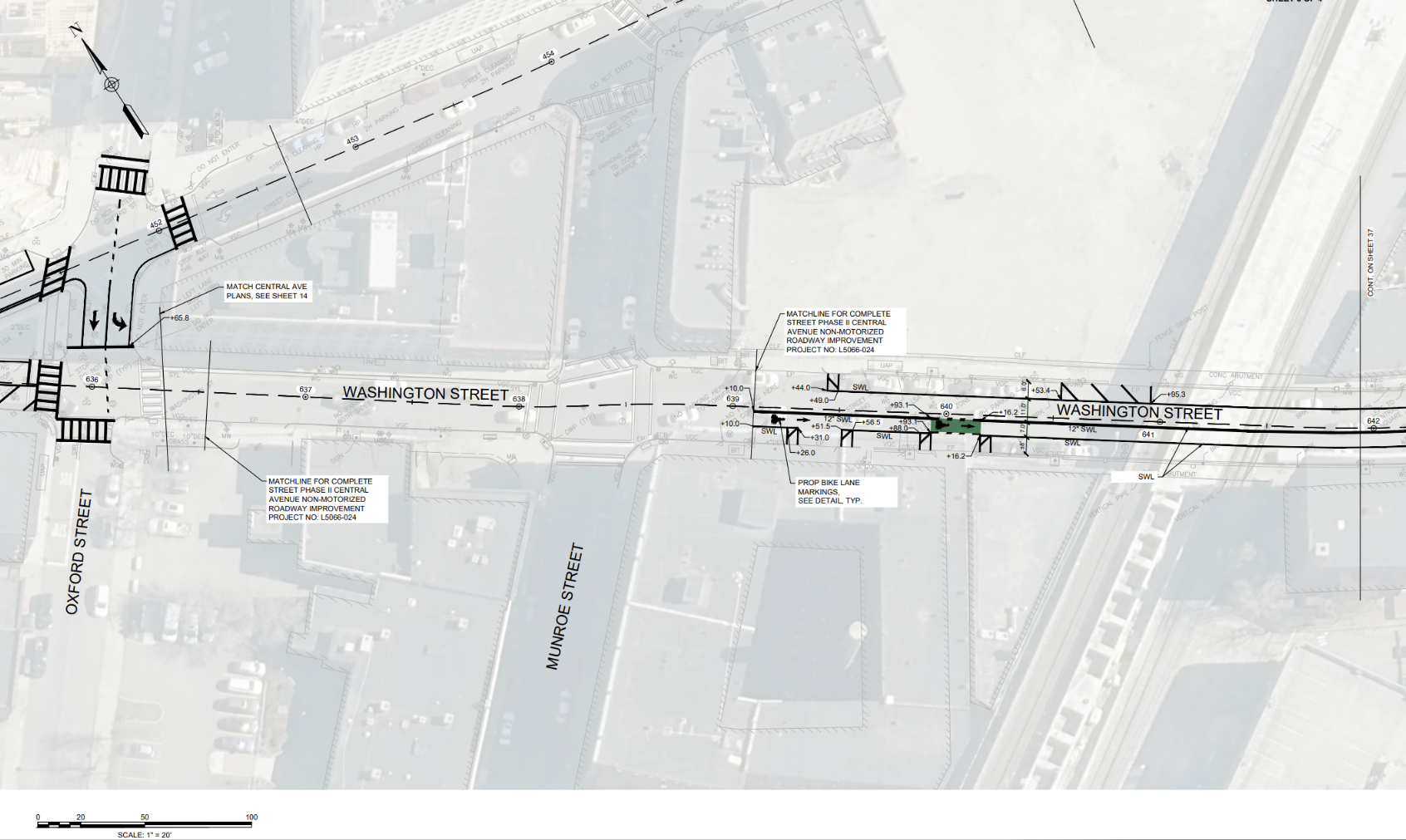
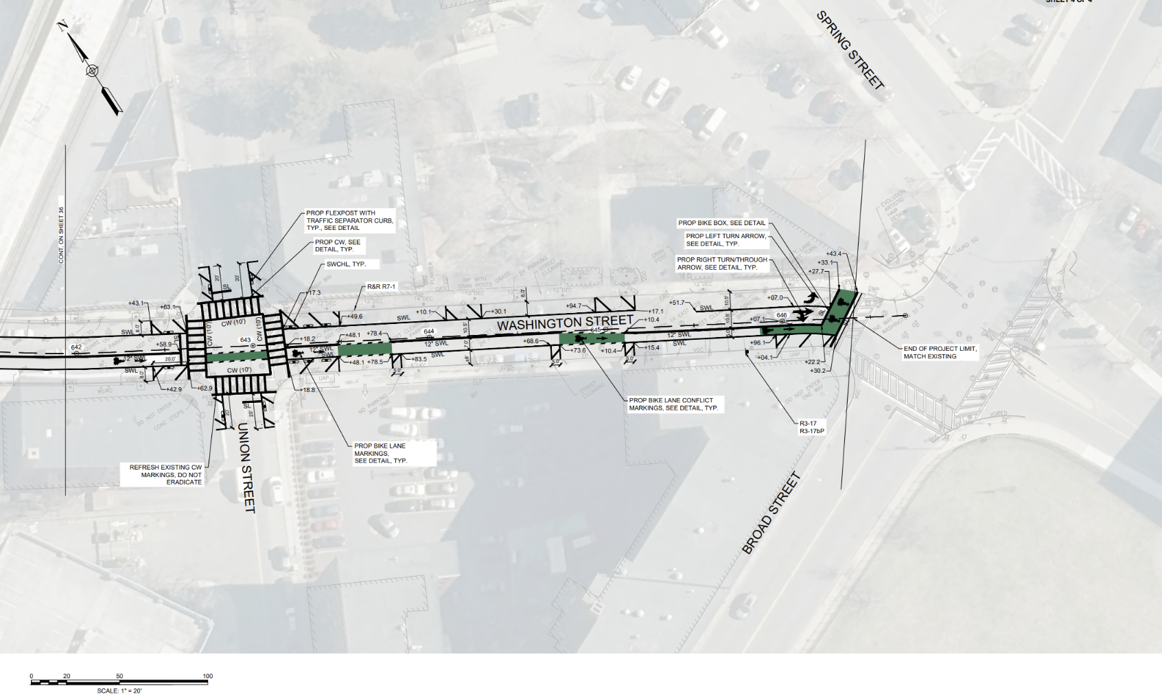
This stretch begins at the intersection of Essex St and Washington St, and heads Southeast until it skips a portion of Washington St between Oxford St and Munroe St. It then picks back up on Washington St directly Southeast of Munroe St, and continues until Washington St meets Broad St. See below for diagrams depicting the extents of the project as well as specific details on the design. To get a closer look, right click on the images to download or open in a new tab!
WASHINGTON ST
This stretch begins at the intersection of Essex St and Washington St, and heads Southeast until it skips a portion of Washington St between Oxford St and Munroe St. It then picks back up on Washington St directly Southeast of Munroe St, and continues until Washington St meets Broad St. See below for diagrams depicting the extents of the project as well as specific details on the design. To get a closer look, right click on the images to download or open in a new tab!


-
Commercial St
Share Commercial St on Facebook Share Commercial St on X (formerly Twitter) Share Commercial St on Linkedin Email Commercial St linkCOMMERCIAL ST
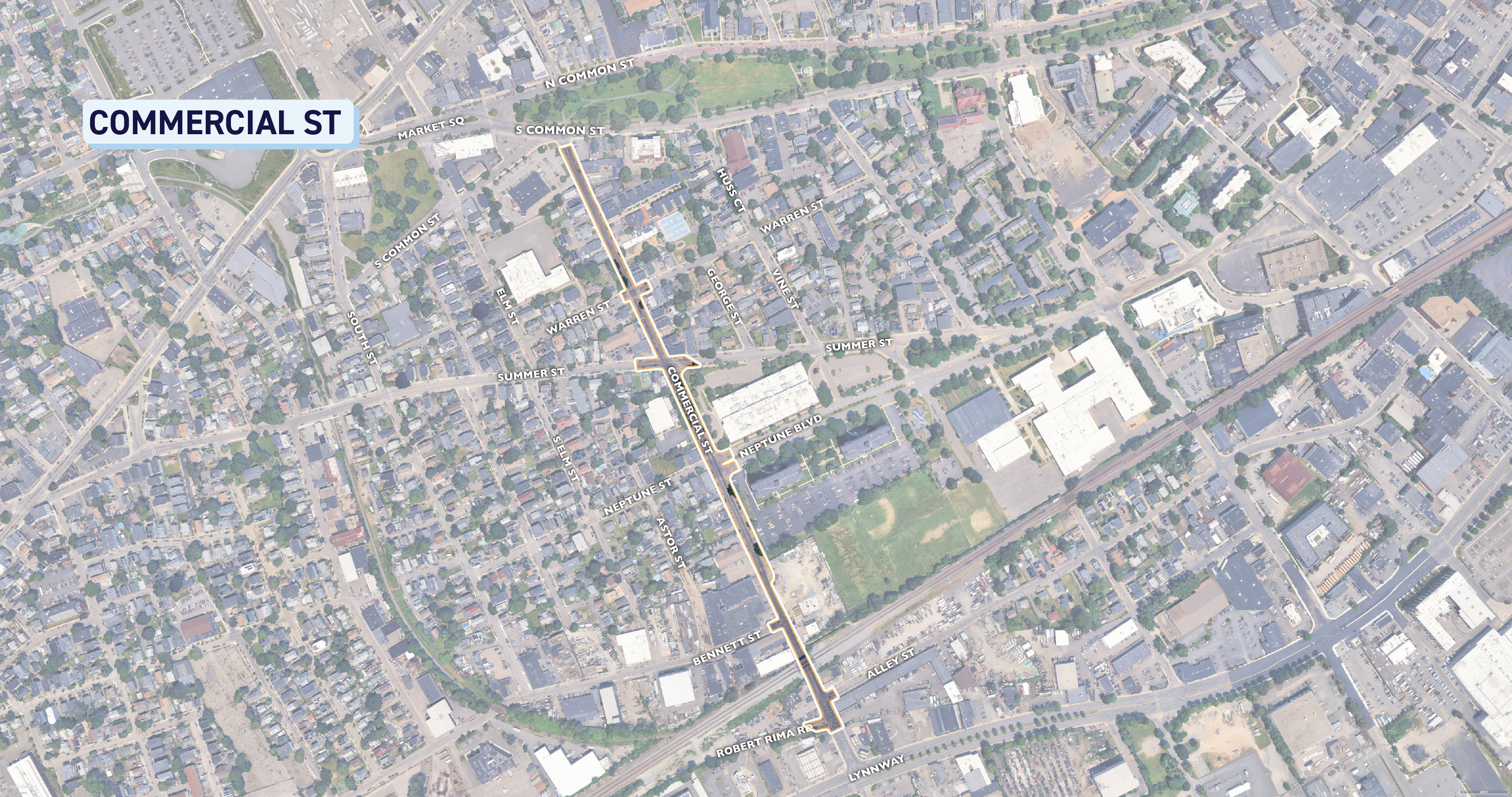
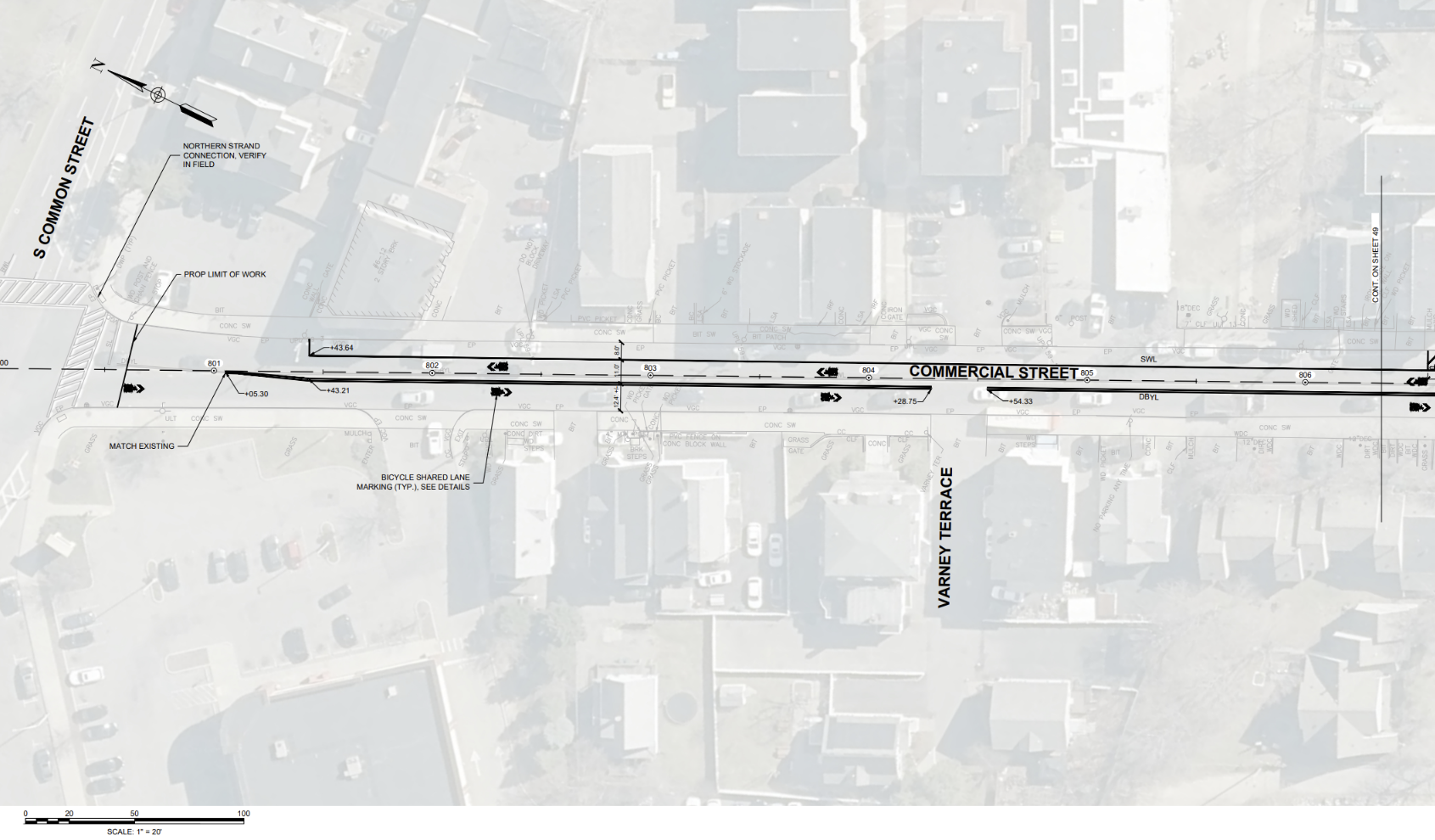
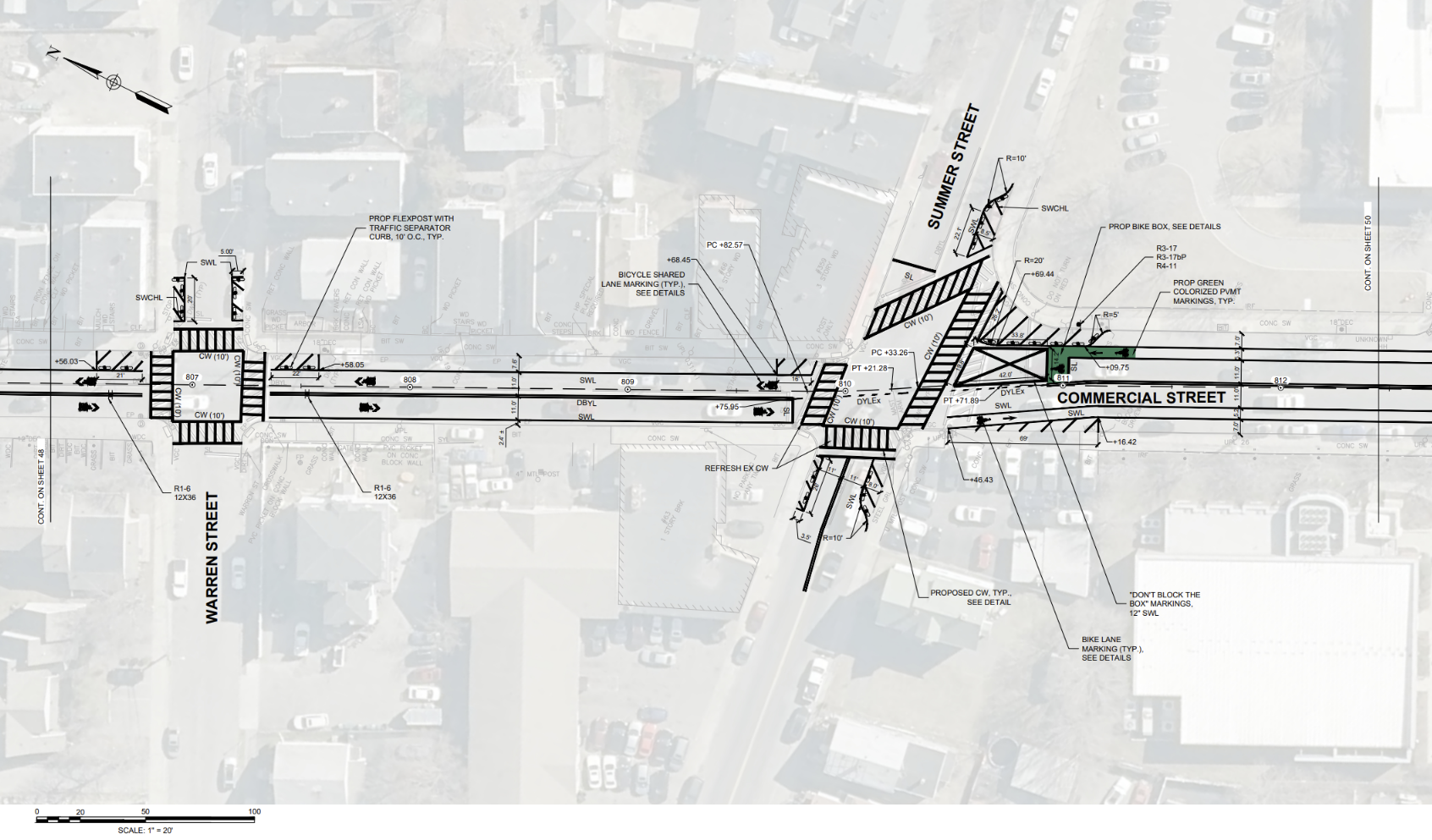
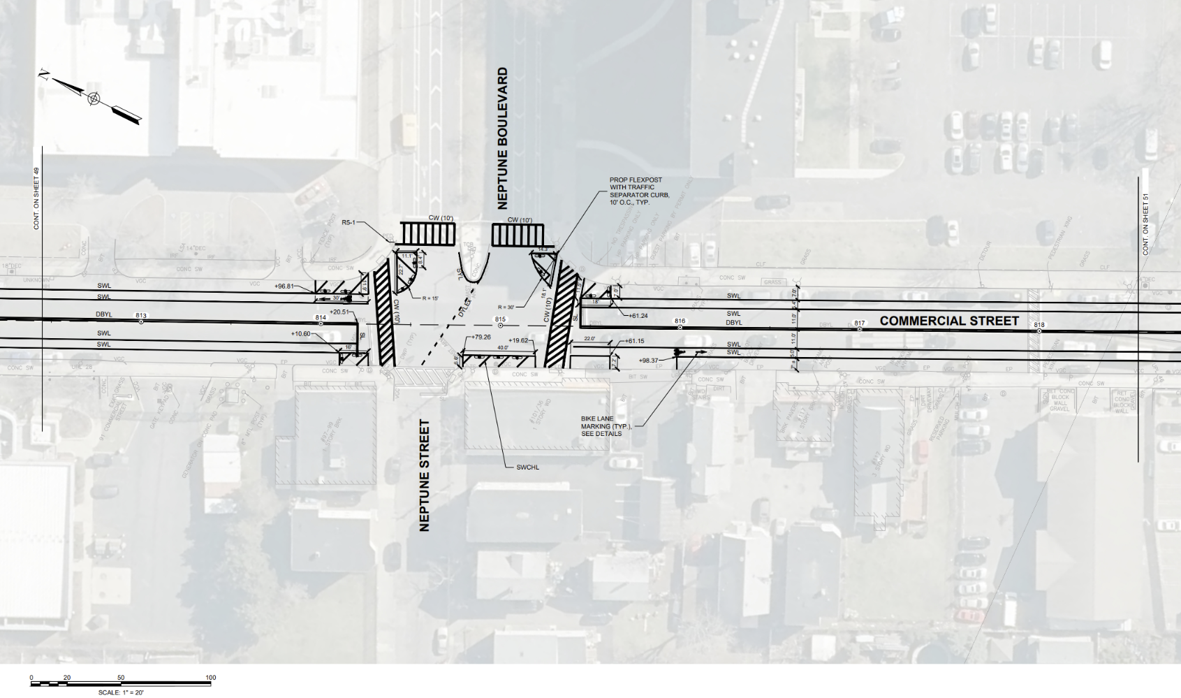
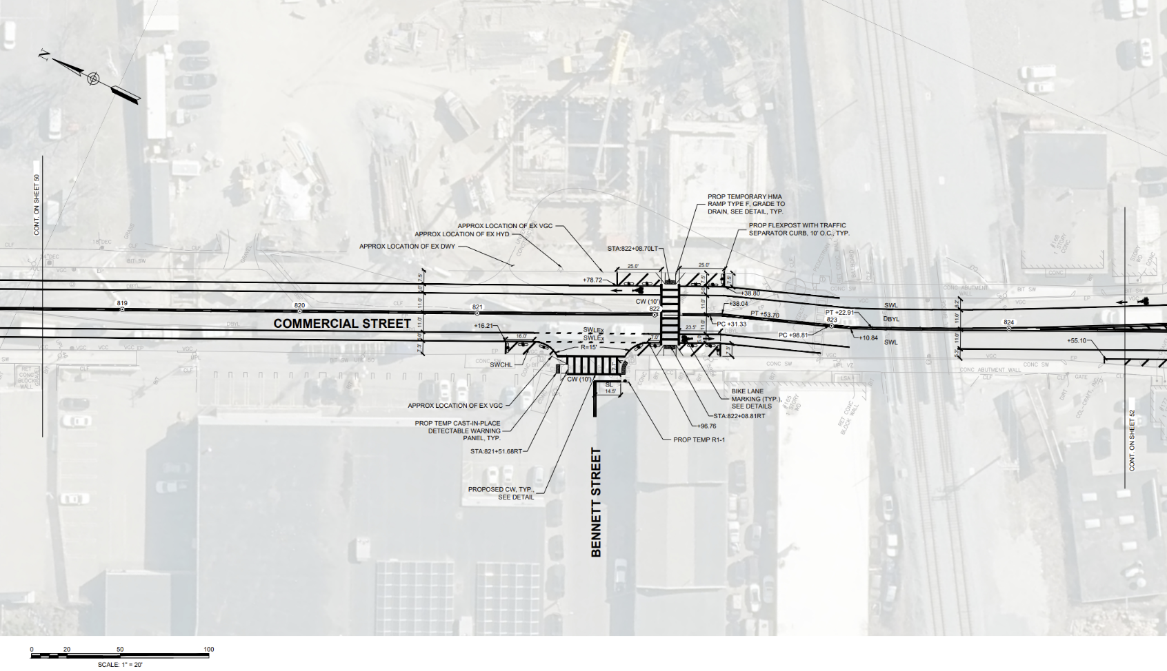
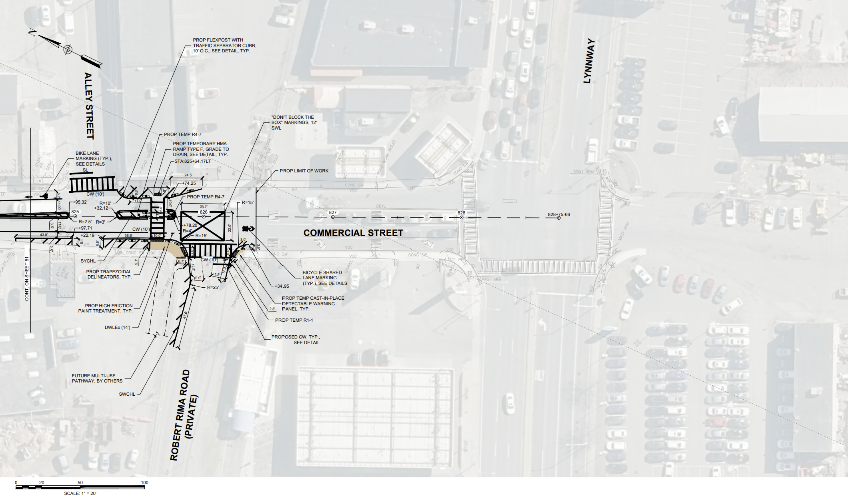
This portion begins where Commercial St meets S Common St, and heads Southeast until just after Robert Rima Rd, slightly before meeting the Lynnway. See below for diagrams depicting the extents of the project as well as specific details on the design. To get a closer look, right click on the images to download or open in a new tab!


COMMERCIAL ST
This portion begins where Commercial St meets S Common St, and heads Southeast until just after Robert Rima Rd, slightly before meeting the Lynnway. See below for diagrams depicting the extents of the project as well as specific details on the design. To get a closer look, right click on the images to download or open in a new tab!


To learn more, join us for a virtual meeting hosted by the Lynn City Council.
Virtual Meeting: Safe Streets for People
Wednesday, October 28 | 7pm
-
Quick Build Implementation
Safe Streets for People - Quick Build is currently at this stageSpring 2027 | We'll use flex posts and paint to test safety improvements.
-
Review Quick Build Results
this is an upcoming stage for Safe Streets for People - Quick BuildSummer 2027 - Fall 2027 | We will see how the Quick Build projects work in action and make changes to our more permanent designs based on what we learn.
-
Implement More Permanent Designs
this is an upcoming stage for Safe Streets for People - Quick Build2029 | Based on the results of our Quick Build projects, we will utilize lane striping, flex posts as well as new curbs, improved sidewalks, and ADA accessibility tools to support more permanent improvements along these priority corridors.